Sites and Monuments Record · Ireland
Ritual site - holy well
Cooldurragha (Fermoy By., Carrigleamleary Par.), County Cork, Ireland
The record
- Townland
- Cooldurragha (Fermoy By., Carrigleamleary Par.)
- County
- Cork
- Country
- Ireland
- First-edition OS map
- NULL
- Latest-edition OS map
- Tubber an eeling (1937)
- Coordinates
- 52.17413, -8.58574
- SMR number
- CO025-063002-
Slide toward Today to fade the historical sheet and see the modern map underneath.
David Rumsey Map Collection, Stanford LibrariesDavid Rumsey Map Collection, Stanford LibrariesDavid Rumsey Map Collection, Stanford LibrariesDavid Rumsey Map Collection, Stanford Libraries
4 historical maps cover this location, the earliest the 1790 map "Composite: Ireland." (David Rumsey Map Collection, Stanford Libraries).
Historical maps covering this location
- 1790 · Composite: Ireland. (David Rumsey Map Collection, Stanford Libraries)
- 1882 · Ireland (southern half). (David Rumsey Map Collection, Stanford Libraries)
- 1883 · Ireland 3. (David Rumsey Map Collection, Stanford Libraries)
- 1904 · Sheet 13. (David Rumsey Map Collection, Stanford Libraries)
This record in the National Monuments Service's Historic Environment Viewer ↗
The National Monuments Service's description
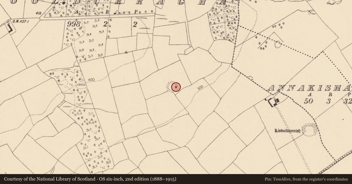
This holy well is referred to in the 'Archaeological Inventory of County Cork - vol. 4 North Cork' (2000, 257) under the entry (no. 12349) for a rath (CO025-063001-). The reference to the holy well in the entry is as follows: Well depicted inside ESE bank on 1842 OS 6-inch map; in ESE fosse on 1937 OS 6-inch map and named Tubber an eeling. According to OS Memoranda (20-12-1931), 'locals call fort 'Tober aneeling'.
The above description is derived from the published 'Archaeological Inventory of County Cork. Volume 4: North Cork' (Dublin: Stationery Office, 2000). In certain instances the entries have been revised and updated in the light of recent research.
Date of upload/revision: 14 January 2009
Nearby in the register
- Ringfort - rathunder 1 mi
- Enclosureunder 1 mi
- Ringfort - rathunder 1 mi
- Quarryunder 1 mi
Other entries of the same register within about three miles of this one, by straight line.