Sites and Monuments Record · Ireland
Graveyard
Clogheen (Fermoy By.), County Cork, Ireland
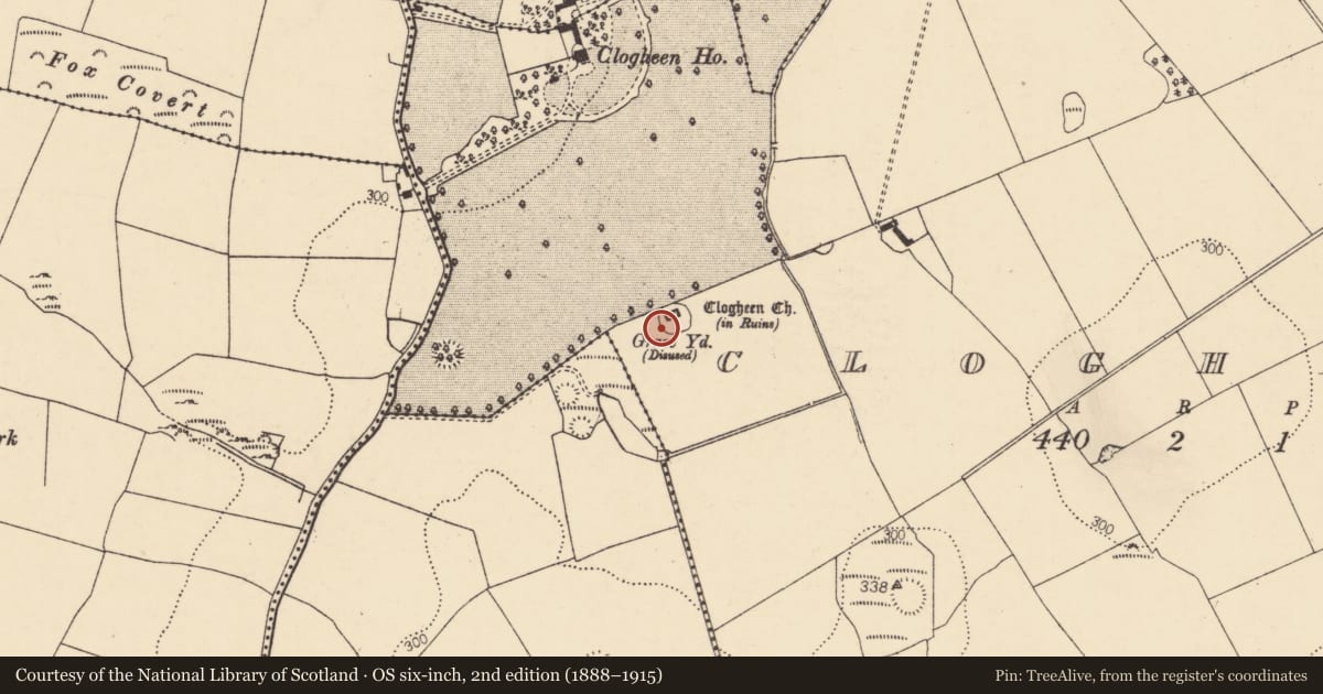
The record
- Townland
- Clogheen (Fermoy By.)
- County
- Cork
- Country
- Ireland
- First-edition OS map
- NULL
- Latest-edition OS map
- Grave Yard (1937)
- Coordinates
- 52.20814, -8.63253
- SMR number
- CO025-016001-
Slide toward Today to fade the historical sheet and see the modern map underneath.
David Rumsey Map Collection, Stanford LibrariesDavid Rumsey Map Collection, Stanford LibrariesDavid Rumsey Map Collection, Stanford LibrariesDavid Rumsey Map Collection, Stanford Libraries
4 historical maps cover this location, the earliest the 1790 map "Composite: Ireland." (David Rumsey Map Collection, Stanford Libraries).
Historical maps covering this location
- 1790 · Composite: Ireland. (David Rumsey Map Collection, Stanford Libraries)
- 1882 · Ireland (southern half). (David Rumsey Map Collection, Stanford Libraries)
- 1883 · Ireland 3. (David Rumsey Map Collection, Stanford Libraries)
- 1904 · Sheet 13. (David Rumsey Map Collection, Stanford Libraries)
This record in the National Monuments Service's Historic Environment Viewer ↗
The National Monuments Service's description
In pasture, atop hillock. Graveyard approached from road c. 300m to W, with causeway over marshy area and cut-stone stile in field boundary; however, Grove White (1905-25, vol. 2, 16) was informed locally that old road led to church from Doneraile-Mallow road to S; S part of this road shown on 1842 OS 6-inch map. Roughly circular graveyard (c. 42m WSW-ENE; c. 35m NNW-SSE) enclosed by stone wall (H c. 0.9m) with gateway entrance (Wth 1.6m) to W (see photograph ibid., opp. 6); internal fosse (D 0.7m) to N. Rectangular walled extension in NW corner accommodates grave plot of Patrick Piggot (1925AD). Ruin of C of I parish church of Caherduggan (14711) off-centre to N; site of earlier church (14408) also here. Earliest headstone noted dated 1781; two low uninscribed gravemarkers lie N of church.
The above description is derived from the published 'Archaeological Inventory of County Cork. Volume 4: North Cork' (Dublin: Stationery Office, 2000). In certain instances the entries have been revised and updated in the light of recent research.
Date of upload/revision: 14 January 2009
Nearby in the register
- Churchunder 1 mi
- Ringfort - rathunder 1 mi
- Souterrainunder 1 mi
- Ringfort - rathunder 1 mi
Other entries of the same register within about three miles of this one, by straight line.