Sites and Monuments Record · Ireland
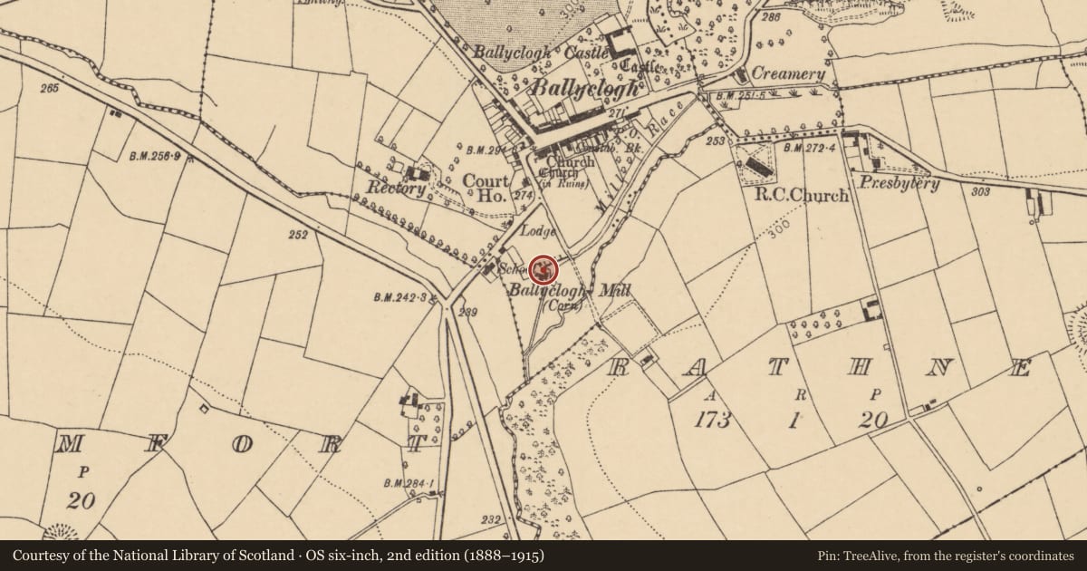
Mill - corn
Ballyclogh (Orrery and Kilmore By.), County Cork, Ireland
The record
- Townland
- Ballyclogh (Orrery and Kilmore By.)
- County
- Cork
- Country
- Ireland
- Latest-edition OS map
- Ballyclogh Mill (Corn) (1937)
- Coordinates
- 52.16544, -8.74268
- SMR number
- CO024-137----
Slide toward Today to fade the historical sheet and see the modern map underneath.
David Rumsey Map Collection, Stanford LibrariesDavid Rumsey Map Collection, Stanford LibrariesDavid Rumsey Map Collection, Stanford LibrariesDavid Rumsey Map Collection, Stanford Libraries
4 historical maps cover this location, the earliest the 1790 map "Composite: Ireland." (David Rumsey Map Collection, Stanford Libraries).
Historical maps covering this location
- 1790 · Composite: Ireland. (David Rumsey Map Collection, Stanford Libraries)
- 1882 · Ireland (southern half). (David Rumsey Map Collection, Stanford Libraries)
- 1883 · Ireland 3. (David Rumsey Map Collection, Stanford Libraries)
- 1904 · Sheet 13. (David Rumsey Map Collection, Stanford Libraries)
This record in the National Monuments Service's Historic Environment Viewer ↗
The National Monuments Service's description
On NW bank of Finnow Stream, c. 200m S of Ballyclogh. Ivy-clad ruin of rectangular mill (11.5m N-S; 8m E-W): 3-bay, 3-storey with attic; gable-ended, with collapsing slate roof. Interior has some remains of wooden floors and machinery, all in advanced state of collapse. Wheel-pit (Wth 2.36m), alongside S end of E wall, contains low-breast-shot suspension cast-iron waterwheel (diam. c. 4.6m; Wth 1.9m); iron plaque on wheel reads "W.S. Winey, Cork"; wheel has square wooden shaft and decayed wooden unventilated buckets. Pinion-wheel shaft transfers power from wheel to tall vertical wooden shaft; shaft has date "1816" painted on it. Latter turned cast-iron great spur wheel, which has wooden clasp-arms and cogs. In pile of rubble nearby are stone-nut, spindle and French-burr bedstone. Vertical shaft has gear wheel, cogs facing downwards, at 1st-floor level; above gear wheel shaft is thin metal column, terminating in a bevelled gear wheel. Built against S wall is roofless rectangular grain-drying kiln (6.2m N-S; 6.7m E-W). Only lower courses of central furnace survive; overhead are remains of ceramic kiln-tile floor. Built against S end of W wall of mill is rectangular gabled extension (c. 11.7m E-W; 5.75m N-S): 4-bay, 4-storey; slate roof partially intact; brick-arched opes. Interior has decayed wooden floors; no machinery.
Described by Lewis (1837, vol. 1, 129) as 'extensive boulting-mills of Messers. Haines and Smith...giving employment to 25 persons.'
The above description is derived from the published 'Archaeological Inventory of County Cork. Volume 4: North Cork' (Dublin: Stationery Office, 2000). In certain instances the entries have been revised and updated in the light of recent research.
Date of upload/revision: 14 January 2009
Nearby in the register
- Churchunder 1 mi
- Graveyardunder 1 mi
- Churchunder 1 mi
- Ringfort - rathunder 1 mi
Other entries of the same register within about three miles of this one, by straight line.