Sites and Monuments Record · Ireland
Graveyard
Aghacross, County Cork, Ireland
The record
- Townland
- Aghacross
- County
- Cork
- Country
- Ireland
- First-edition OS map
- NULL
- Latest-edition OS map
- Grave Yard (1935)
- Coordinates
- 52.25694, -8.39126
- SMR number
- CO019-002001-
Slide toward Today to fade the historical sheet and see the modern map underneath.
David Rumsey Map Collection, Stanford LibrariesDavid Rumsey Map Collection, Stanford LibrariesDavid Rumsey Map Collection, Stanford LibrariesDavid Rumsey Map Collection, Stanford Libraries
4 historical maps cover this location, the earliest the 1790 map "Composite: Ireland." (David Rumsey Map Collection, Stanford Libraries).
Historical maps covering this location
- 1790 · Composite: Ireland. (David Rumsey Map Collection, Stanford Libraries)
- 1882 · Ireland (southern half). (David Rumsey Map Collection, Stanford Libraries)
- 1891 · Ireland 16 (David Rumsey Map Collection, Stanford Libraries)
- 1904 · Sheet 13. (David Rumsey Map Collection, Stanford Libraries)
This record in the National Monuments Service's Historic Environment Viewer ↗
The National Monuments Service's description
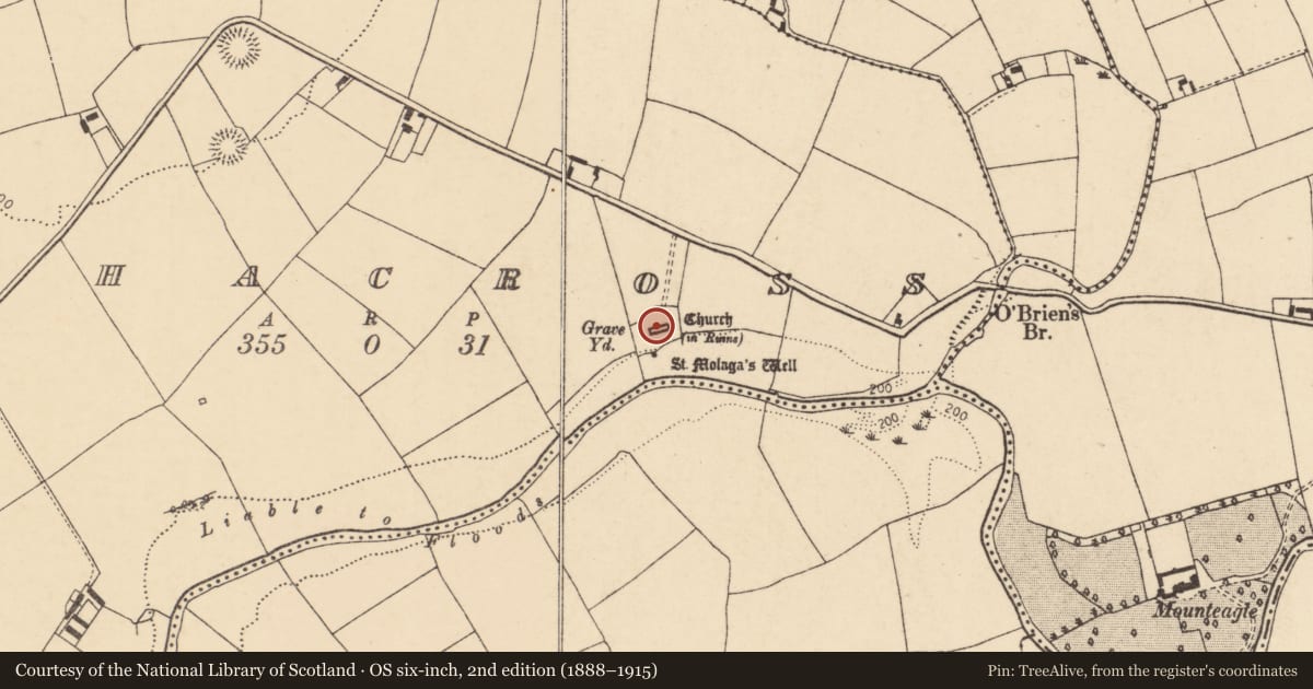
In pasture, on N bank of Funshion River, within early ecclesiastical site (13873). Pentagonal graveyard (c. 70m WSW-ESE; c. 50m max. NNW-SSE) enclosed by stone-faced earthen bank; S third of graveyard slopes steeply down to S. Entered to N by stone stile, dated 1877, and recent gate. Low parallel earthen banks (c. 100m N-S) define straight trackway leading from road to graveyard. Ruin of parish church of Aghacross (14387) in centre. In use; earliest headstone noted dated 1740. Many low uninscribed gravemarkers, to W, S and E of church; mostly 20th-century burials to N of church (Hanley et al. 1995, 37-47). Many graves evident in interior of church, including vault at foot of 18th-century Massy tomb, at E end of church. Holy well (13934), near SW corner.
The above description is derived from the published 'Archaeological Inventory of County Cork. Volume 4: North Cork' (Dublin: Stationery Office, 2000). In certain instances the entries have been revised and updated in the light of recent research.
Date of upload/revision: 14 January 2009
Nearby in the register
- Churchunder 1 mi
- Ecclesiastical enclosureunder 1 mi
- Bullaun stoneunder 1 mi
- Ritual site - holy wellunder 1 mi
Other entries of the same register within about three miles of this one, by straight line.