Sites and Monuments Record · Ireland
Flat cemetery
Ballyenahan North, County Cork, Ireland
The record
- Townland
- Ballyenahan North
- County
- Cork
- Country
- Ireland
- First-edition OS map
- NULL
- Latest-edition OS map
- Not indicated
- Coordinates
- 52.23593, -8.40885
- SMR number
- CO018-051----
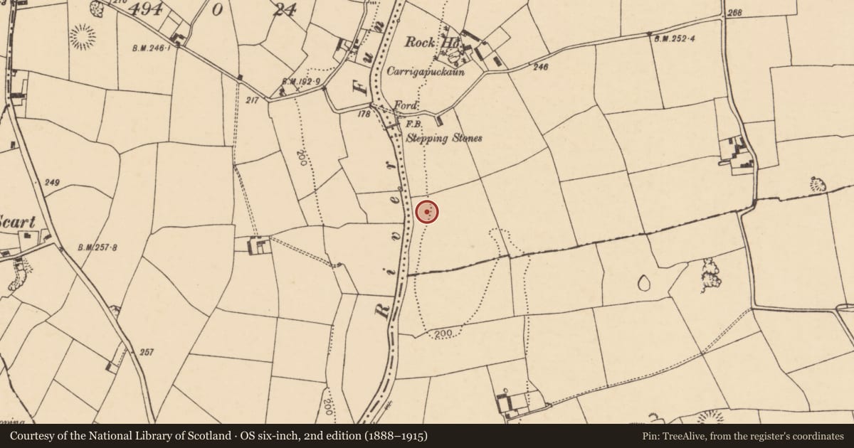
Slide toward Today to fade the historical sheet and see the modern map underneath.
David Rumsey Map Collection, Stanford LibrariesDavid Rumsey Map Collection, Stanford LibrariesDavid Rumsey Map Collection, Stanford LibrariesDavid Rumsey Map Collection, Stanford Libraries
4 historical maps cover this location, the earliest the 1790 map "Composite: Ireland." (David Rumsey Map Collection, Stanford Libraries).
Historical maps covering this location
- 1790 · Composite: Ireland. (David Rumsey Map Collection, Stanford Libraries)
- 1882 · Ireland (southern half). (David Rumsey Map Collection, Stanford Libraries)
- 1891 · Ireland 16 (David Rumsey Map Collection, Stanford Libraries)
- 1904 · Sheet 13. (David Rumsey Map Collection, Stanford Libraries)
This record in the National Monuments Service's Historic Environment Viewer ↗
The National Monuments Service's description
On gravel ridge, on E bank of Funshion River. Discovered in 1949 during gravel quarrying operations. Probable total of seventeen graves found, of which six investigated by Fahy (1954, 42-49, listed as graves A to F).
Grave A: rectangular cist (0.88m x 0.39m; D 0.57m; long axis E-W); sandstone side slabs supporting capstone of limestone; contained disturbed cremation of young adult, probably female, mingled with 16 bronze rivets. Grave B: undisturbed polygonal cist (0.87m x 0.6m; D 0.5m; long axis N-S); packstones used atop side slabs to take limestone capstone; cremated bones of two children, 4 and 8-10 years of age, heaped on limestone basal slab. Two large boulders placed over capstone. Grave C: rectangular cist (0.95m x 0.52m; D 0.55m; long axis E-W); capstone and E sidestone removed; remaining sides and base made of sandstone slabs. Contained crouched inhumation of robust adult male, 25-50 years of age; one sherd of Food Vessel survived disturbance. Grave D: largely destroyed short cist; covering slab survived; also quantity of undiagnostic cremated bone. Grave E: pit burial (D 2.4m; diam. 2.4m) containing inhumation of tall adult male covered with boulders; rest of pit back-filled with gravel; skeleton accompanied by bronze dagger. Grave F: oval pit (0.85m x 0.55m; D 0.55m; long axis N-S) containing cremated bones of child, 2-7 years of age, deposited at deeper S end of pit; inverted Food Vessel Bowl at N end. Bowl described as tripartite, decorated with plain ribs alternating with zig-zag bands in false relief; tripartite division defined by body ridges decorated with tooth comb impressions; two vertical stops applied over false relief (ibid., 43-5).
Exact findspot of a Food Vessel Vase found within cemetery unknown; this is biconical, with everted-rim; decorated with hatched triangles, herringbone bands and parallel cord-impressed lines above and below shoulder and at base (ibid., 45). (Waddell 1990, 58-9; Doody 1986, Cork No. 8).
The above description is derived from the published 'Archaeological Inventory of County Cork. Volume 4: North Cork' (Dublin: Stationery Office, 2000). In certain instances the entries have been revised and updated in the light of recent research.
Date of upload/revision: 14 January 2009
Nearby in the register
- Kiln - limeunder 1 mi
- Castle - unclassifiedunder 1 mi
- Ringfort - rathunder 1 mi
- Ringfort - rathunder 1 mi
Other entries of the same register within about three miles of this one, by straight line.