Sites and Monuments Record · Ireland
Country house
Farahy, County Cork, Ireland
The record
- Townland
- Farahy
- County
- Cork
- Country
- Ireland
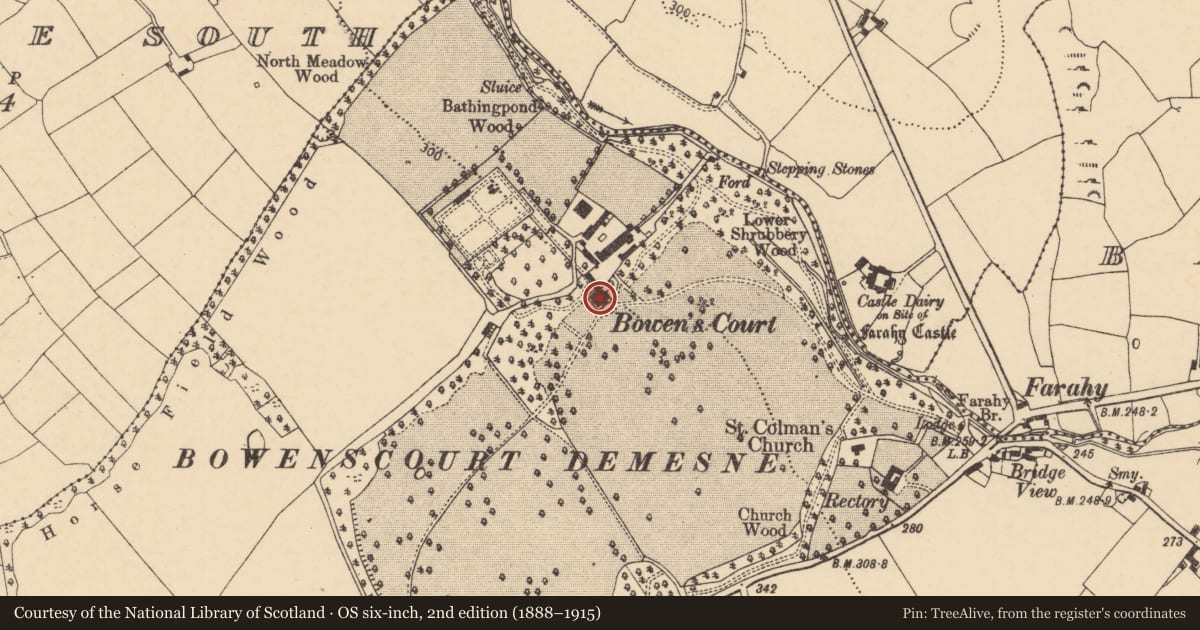
- Latest-edition OS map
- Bowens Court (1936)
- Coordinates
- 52.24536, -8.46107
- SMR number
- CO018-034----
Slide toward Today to fade the historical sheet and see the modern map underneath.
David Rumsey Map Collection, Stanford LibrariesDavid Rumsey Map Collection, Stanford LibrariesDavid Rumsey Map Collection, Stanford LibrariesDavid Rumsey Map Collection, Stanford Libraries
4 historical maps cover this location, the earliest the 1790 map "Composite: Ireland." (David Rumsey Map Collection, Stanford Libraries).
Historical maps covering this location
- 1790 · Composite: Ireland. (David Rumsey Map Collection, Stanford Libraries)
- 1882 · Ireland (southern half). (David Rumsey Map Collection, Stanford Libraries)
- 1891 · Ireland 16 (David Rumsey Map Collection, Stanford Libraries)
- 1904 · Sheet 13. (David Rumsey Map Collection, Stanford Libraries)
This record in the National Monuments Service's Historic Environment Viewer ↗
The National Monuments Service's description
Site of house built by Henry Bowen and completed in 1775 (Bowen 1942, 123), close to site of an earlier house. Architects name is unknown (ibid., 124) but design has been attributed to Isaac Rothery (Bence-Jones 1978, 46). Photograph (Grove White 1905-25, vol. 1, opp. 292) shows 3-storey house over basement. Entrance front of ashlar limestone (SE) is 7-bays wide, with central 3-bay breakfront framed by quoins; central pedimented door case; sash windows with moulded surrounds. SW elevation of 6 bays; according to Bence-Jones (ibid.), NE elevation never completed and infilled in late 19th century with lower service wings. Upper floor contained long room (intended as ballroom) extending full length of house. Hipped roof with central valley. Former home of Elizabeth Bowen the author (Bowen ibid.). House demolished c. 1961. Some farm buildings, entrance piers and two lodges survive; C of I church (14715), on edge of demesne, to SE.
The above description is derived from the published 'Archaeological Inventory of County Cork. Volume 4: North Cork' (Dublin: Stationery Office, 2000). In certain instances the entries have been revised and updated in the light of recent research.
Date of upload/revision: 14 January 2009
Nearby in the register
- Castle - unclassifiedunder 1 mi
- Churchunder 1 mi
- Graveyardunder 1 mi
- Ringfort - rathunder 1 mi
Other entries of the same register within about three miles of this one, by straight line.