Sites and Monuments Record · Ireland
Graveyard
Oldcourt (Fermoy By.), County Cork, Ireland
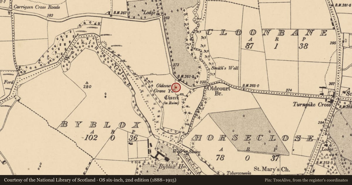
The record
- Townland
- Oldcourt (Fermoy By.)
- County
- Cork
- Country
- Ireland
- First-edition OS map
- NULL
- Latest-edition OS map
- Oldcourt Grave Yard (1937)
- Coordinates
- 52.22431, -8.59252
- SMR number
- CO017-083001-
Slide toward Today to fade the historical sheet and see the modern map underneath.
David Rumsey Map Collection, Stanford LibrariesDavid Rumsey Map Collection, Stanford LibrariesDavid Rumsey Map Collection, Stanford LibrariesDavid Rumsey Map Collection, Stanford Libraries
4 historical maps cover this location, the earliest the 1790 map "Composite: Ireland." (David Rumsey Map Collection, Stanford Libraries).
Historical maps covering this location
- 1790 · Composite: Ireland. (David Rumsey Map Collection, Stanford Libraries)
- 1882 · Ireland (southern half). (David Rumsey Map Collection, Stanford Libraries)
- 1883 · Ireland 3. (David Rumsey Map Collection, Stanford Libraries)
- 1904 · Sheet 13. (David Rumsey Map Collection, Stanford Libraries)
This record in the National Monuments Service's Historic Environment Viewer ↗
The National Monuments Service's description
On S side of road; on N shoulder of Awbeg River glen. Subrectangular graveyard (c. 60m NNE-SSW; c. 47m WNW-ESE), with triangular extension to W and more recent extension to SW. Once contained chapel-of-ease of Oldcourt/Rossdock, which was in ruin by 1615 (Brady 1863, vol. 2, 184). Older section of graveyard in occasional use and packed with graves; oldest legible headstones noted dated 1797 and 1799, but Buckley (1907-9b) noted headstones dating to 1726, 1758 and others of mid-late 18th century. Against S boundary of graveyard is low rectangular enclosure (22.65m ext. E-W ; 5m int. N-S) enclosing chest tomb of Rev. Cotter who died in 1784 (Grove White 1905-25, vol. 3, 31); this is mistakenly identified as remains of church on 1937 OS 6-inch map.
The above description is derived from the published 'Archaeological Inventory of County Cork. Volume 4: North Cork' (Dublin: Stationery Office, 2000). In certain instances the entries have been revised and updated in the light of recent research.
Date of upload/revision: 14 January 2009
Nearby in the register
- Churchunder 1 mi
- Burial groundunder 1 mi
- Promontory fort - inlandunder 1 mi
- Ringfort - rathunder 1 mi
Other entries of the same register within about three miles of this one, by straight line.