Sites and Monuments Record · Ireland
Mill - fulling
Ballymee, County Cork, Ireland
The record
- Townland
- Ballymee
- County
- Cork
- Country
- Ireland
- Latest-edition OS map
- Indicated (1937)
- Coordinates
- 52.22452, -8.62494
- SMR number
- CO017-073001-
Slide toward Today to fade the historical sheet and see the modern map underneath.
David Rumsey Map Collection, Stanford LibrariesDavid Rumsey Map Collection, Stanford LibrariesDavid Rumsey Map Collection, Stanford LibrariesDavid Rumsey Map Collection, Stanford Libraries
4 historical maps cover this location, the earliest the 1790 map "Composite: Ireland." (David Rumsey Map Collection, Stanford Libraries).
Historical maps covering this location
- 1790 · Composite: Ireland. (David Rumsey Map Collection, Stanford Libraries)
- 1882 · Ireland (southern half). (David Rumsey Map Collection, Stanford Libraries)
- 1883 · Ireland 3. (David Rumsey Map Collection, Stanford Libraries)
- 1904 · Sheet 13. (David Rumsey Map Collection, Stanford Libraries)
This record in the National Monuments Service's Historic Environment Viewer ↗
The National Monuments Service's description
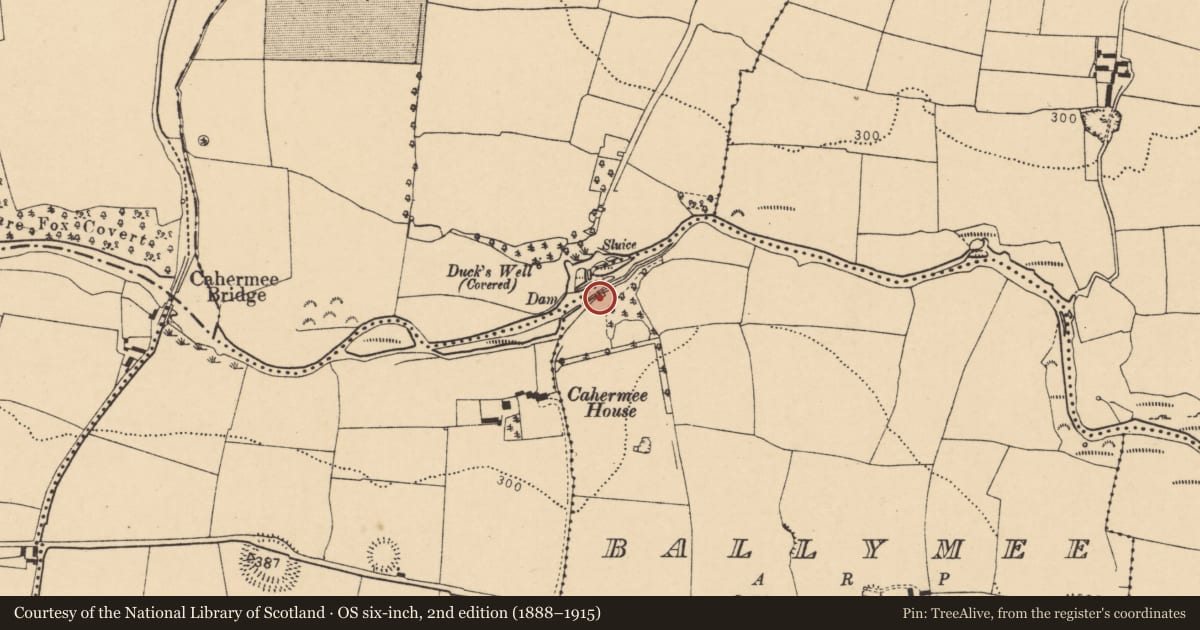
On SE bank of Awbeg River, 150m NE of Cahermee House (14863) and c. 650m E of Tuck mill (15248). Fragmentary remains of two tuck mills, indicated on 1842 OS 6-inch map as two rectangular structures (long axes NW-SE). On SE bank of river is NW end of 2-storey rectangular structure (int. 10.52m NW-SE; 5.41m SW-NE) of random-rubble limestone construction. Millrace channel (dry) passes through centre of building under arched opening (Wth c. 1.35m) in SW and NE walls. Door opes in SW and NE walls. North-west elevation has two 1st-floor windows and chimney atop gable. Runner millstone, now lying in millrace, suggests mill once used for grinding corn.
Partial remains of second tuck mill c. 40m to S: rectangular structure (10.7m NW-SE; 4.35m NE-SW) of random-rubble limestone construction. SE gable partially formed by rock face, only outline of SW and NW walls survives. No evidence of millrace, but top of tail-race arch in NE wall. Line of rubble stones in interior may be remains of dividing wall. Pond immediately to SW probably mill pond. Millrace indicated on 1842 OS 6-inch map taken from river c. 400m to W, divides c. 60m to W to feed both mills.
The above description is derived from the published 'Archaeological Inventory of County Cork. Volume 4: North Cork' (Dublin: Stationery Office, 2000). In certain instances the entries have been revised and updated in the light of recent research.
Date of upload/revision: 14 January 2009
Nearby in the register
- Mill - fullingunder 1 mi
- Ritual site - holy wellunder 1 mi
- Fulacht fiaunder 1 mi
- Castle - unclassifiedunder 1 mi
Other entries of the same register within about three miles of this one, by straight line.