Sites and Monuments Record · Ireland
Religious house - unclassified
Buttevant, County Cork, Ireland
The record
- Townland
- Buttevant
- County
- Cork
- Country
- Ireland
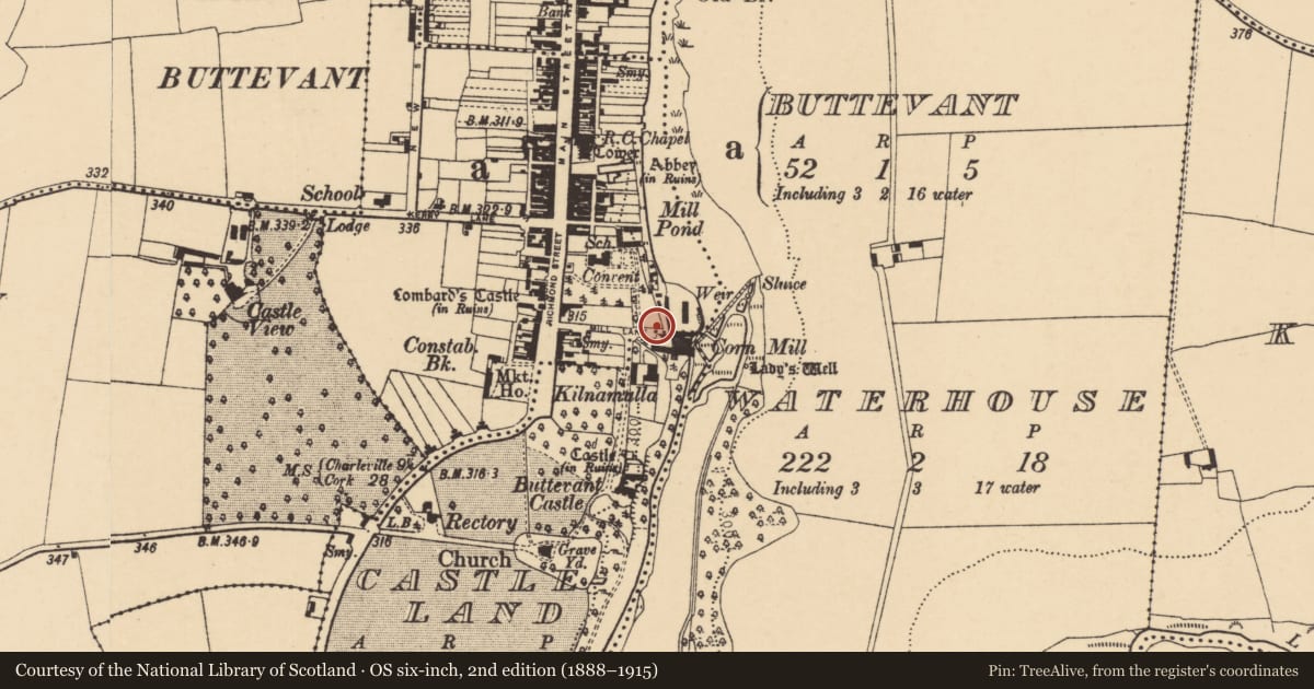
- Latest-edition OS map
- Old RC Chapel (1842)
- Coordinates
- 52.22963, -8.66820
- SMR number
- CO017-053007-
Slide toward Today to fade the historical sheet and see the modern map underneath.
David Rumsey Map Collection, Stanford LibrariesDavid Rumsey Map Collection, Stanford LibrariesDavid Rumsey Map Collection, Stanford LibrariesDavid Rumsey Map Collection, Stanford Libraries
4 historical maps cover this location, the earliest the 1790 map "Composite: Ireland." (David Rumsey Map Collection, Stanford Libraries).
Historical maps covering this location
- 1790 · Composite: Ireland. (David Rumsey Map Collection, Stanford Libraries)
- 1882 · Ireland (southern half). (David Rumsey Map Collection, Stanford Libraries)
- 1883 · Ireland 3. (David Rumsey Map Collection, Stanford Libraries)
- 1904 · Sheet 13. (David Rumsey Map Collection, Stanford Libraries)
This record in the National Monuments Service's Historic Environment Viewer ↗
The National Monuments Service's description
In SE corner of Buttevant town. Forming part of S boundary wall of Convent of Mercy graveyard is older wall (L 18m; max. H 2.8m; T 1m). In centre of older wall is blocked window ope, upper part missing; inside edge of embrasure (Wth 1.3m; min. H 1.2m) formed of cut-limestone blocks. This may be all that remains of 'small trefoil-headed two-light window' noted by Brash (1852a, 87). This identified by Brash (1852a, 87) as probably remains of structure described by Smith (1750, vol. 1, 314) as 'part of another ruin' near the Franciscan friary (14382) and 'said to have been a nunnery, dedicated to St Owen; or, according to others, St John the Baptist' (ibid.); Gwynn and Hadcock (1988, 326) note Smith's reference but state that 'no supporting evidence for a nunnery at Buttevant has been found.' This wall might also be remains of RC chapel (14734).
The above description is derived from the published 'Archaeological Inventory of County Cork. Volume 4: North Cork' (Dublin: Stationery Office, 2000). In certain instances the entries have been revised and updated in the light of recent research.
Date of upload/revision: 14 January 2009
Nearby in the register
- Churchunder 1 mi
- Mill - cornunder 1 mi
- Ritual site - holy wellunder 1 mi
- Fever hospitalunder 1 mi
Other entries of the same register within about three miles of this one, by straight line.