Sites and Monuments Record · Ireland
Burnt mound
Scattery Island, County Clare, Ireland
The record
- Townland
- Scattery Island
- County
- Clare
- Country
- Ireland
- First-edition OS map
- Not indicated
- Latest-edition OS map
- Not indicated
- Coordinates
- 52.61425, -9.51734
- SMR number
- CL067-024018-
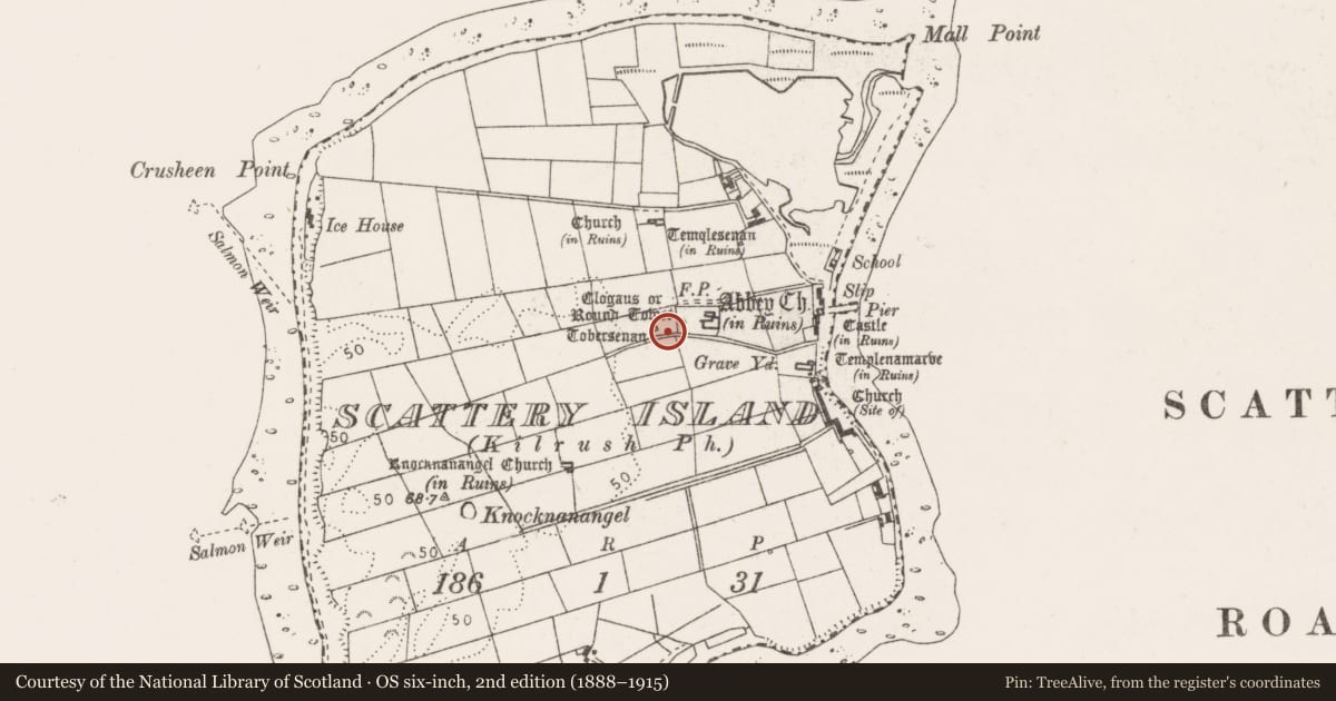
Slide toward Today to fade the historical sheet and see the modern map underneath.
David Rumsey Map Collection, Stanford LibrariesDavid Rumsey Map Collection, Stanford LibrariesDavid Rumsey Map Collection, Stanford LibrariesDavid Rumsey Map Collection, Stanford Libraries
4 historical maps cover this location, the earliest the 1753 map "Mappa geographica Regni Hiberniae" (David Rumsey Map Collection, Stanford Libraries).
Historical maps covering this location
- 1753 · Mappa geographica Regni Hiberniae (David Rumsey Map Collection, Stanford Libraries)
- 1790 · Composite: Ireland. (David Rumsey Map Collection, Stanford Libraries)
- 1869 · Ireland. (David Rumsey Map Collection, Stanford Libraries)
- 1891 · Ireland 16 (David Rumsey Map Collection, Stanford Libraries)
This record in the National Monuments Service's Historic Environment Viewer ↗
The National Monuments Service's description
Situated between the round tower (CL067-024005-) and St Senan's well (CL067-024007-). Discovered during an assessment in 2001 in advance of conservation works to facilitate visitors to the island. A low mound is evident (3.1m N-S; 2.9m E-W; max. H 0.2-0.3m). Rabbit burrowing revealed burnt and fire-cracked fragments of shattered sandstone in a rich organic silty clay. A couple of pieces of burnt clay and a piece of iron slag were also recovered. (Halpin 2002, 10; Dunne 2003, 23-4) This is a national monument in state care, no. 10.
Compiled by: Mary Tunney
Date of upload: 19 September 2016
This monument is subject to a preservation order made under the National Monuments Acts 1930 to 2014 (PO no. 1/1971).
References
Dunne, L. 2003 Scattery Island. In I. Bennett (ed.), Excavations 2001: summary accounts of archaeological excavations in Ireland, 23-4. Bray. Wordwell.
Halpin, S. 2002 Archaeological test excavation report, Scattery Island, Kilrush, Co. Clare. 01E0661. Unpublished excavation report. National Monuments Section, Department of Arts, Heritage, Regional, Rural and Gaeltacht Affairs, Dublin.
Nearby in the register
- Round towerunder 1 mi
- Ritual site - holy wellunder 1 mi
- Graveyardunder 1 mi
- Churchunder 1 mi
Other entries of the same register within about three miles of this one, by straight line.