Sites and Monuments Record · Ireland
Church
Scattery Island, County Clare, Ireland
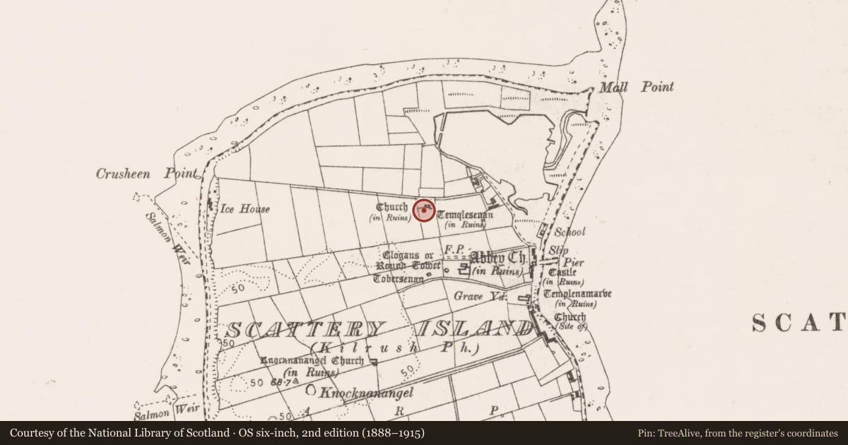
The record
- Townland
- Scattery Island
- County
- Clare
- Country
- Ireland
- First-edition OS map
- Indicated
- Latest-edition OS map
- Church (in Ruins) (1923)
- Coordinates
- 52.61547, -9.51775
- SMR number
- CL067-024002-
Slide toward Today to fade the historical sheet and see the modern map underneath.
David Rumsey Map Collection, Stanford LibrariesDavid Rumsey Map Collection, Stanford LibrariesDavid Rumsey Map Collection, Stanford LibrariesDavid Rumsey Map Collection, Stanford Libraries
4 historical maps cover this location, the earliest the 1753 map "Mappa geographica Regni Hiberniae" (David Rumsey Map Collection, Stanford Libraries).
Historical maps covering this location
- 1753 · Mappa geographica Regni Hiberniae (David Rumsey Map Collection, Stanford Libraries)
- 1790 · Composite: Ireland. (David Rumsey Map Collection, Stanford Libraries)
- 1869 · Ireland. (David Rumsey Map Collection, Stanford Libraries)
- 1891 · Ireland 16 (David Rumsey Map Collection, Stanford Libraries)
This record in the National Monuments Service's Historic Environment Viewer ↗
The National Monuments Service's description
A church-like building known as ‘St Senan’s Bed’ situated just 1.1m to the W of Templesenan (CL067-024003-) on Scattery Island. A simple rectangular structure (ext. dims. 7.92m E-W; 4.77m N-S) on the same alignment as Templesenan, constructed of a rubble core with small facing stones except for the basal course on the inner face of the wall. The walls survive to a maximum height of 1.6m at S. There is a doorway (Wth 0.7m) at the W end of the S wall, its W jamb flush with the inner face of the W wall. It has a chamfer with pyramid stops. The base of a window embrasure remains in the E wall and another in the S wall. This and all the monuments on Scattery Island are national monuments in State care, no. 10. An ogham stone (CL067-024016-) formed part of a seat-like structure standing against the exterior W wall but has been moved into the visitor's centre. A cross-slab with inscriptions (CL067-024017-) lies c. 3m to the W. (Westropp 1897, 285; 1900-02, 170)This is a national monument in state care, no. 10.
The following images have been uploaded:
CL067-024002-_01.jpg Aerial view of St Senan's bed immediately W of Templesenan.
CL067-024002-_02.jpg Ground shot of St Senan's bed and Templesenan.
Compiled by: Michael Moore and Mary Tunney
Date of upload: 7 September 2016
This monument is subject to a preservation order made under the National Monuments Acts 1930 to 2014 (PO no. 1/1971).
References
Westropp, T.J. 1900-02 The churches of Co. Clare and the origin of the ecclesiastical divisions in that county. Proceedings of the Royal Irish Academy, Series 3, vol. 6, 100-180.
Westropp, T.J. 1897 Descriptive sketch of places visited. Part 1. Scattery Island and Canons' island, Co. Clare. Journal of the Royal Society of Antiquaries of Ireland 27, 273-90.
Nearby in the register
- Ogham stoneunder 1 mi
- Cross-slabunder 1 mi
- Cross-slabunder 1 mi
- Churchunder 1 mi
Other entries of the same register within about three miles of this one, by straight line.