Sites and Monuments Record · Ireland
Field system
Ballycasey More, County Clare, Ireland
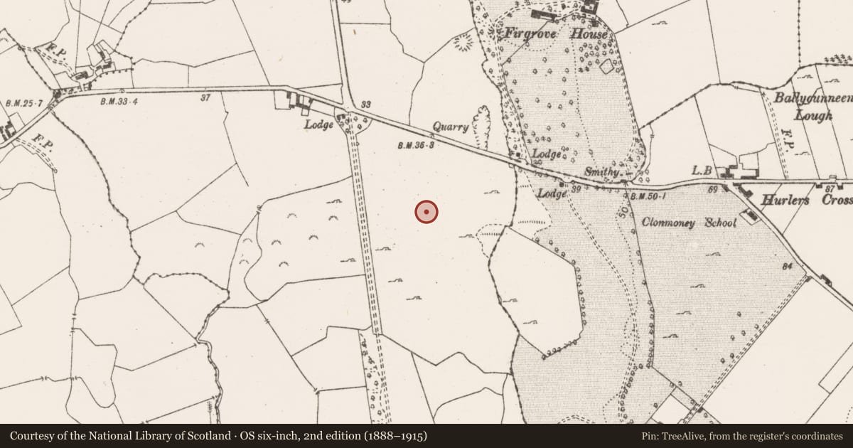
The record
- Townland
- Ballycasey More
- County
- Clare
- Country
- Ireland
- First-edition OS map
- Not indicated
- Latest-edition OS map
- Not indicated
- Coordinates
- 52.71575, -8.85483
- SMR number
- CL051-176002-
Slide toward Today to fade the historical sheet and see the modern map underneath.
David Rumsey Map Collection, Stanford LibrariesDavid Rumsey Map Collection, Stanford LibrariesDavid Rumsey Map Collection, Stanford LibrariesDavid Rumsey Map Collection, Stanford Libraries
4 historical maps cover this location, the earliest the 1790 map "Composite: Ireland." (David Rumsey Map Collection, Stanford Libraries).
Historical maps covering this location
- 1790 · Composite: Ireland. (David Rumsey Map Collection, Stanford Libraries)
- 1869 · Ireland. (David Rumsey Map Collection, Stanford Libraries)
- 1891 · Ireland 16 (David Rumsey Map Collection, Stanford Libraries)
- 1904 · Sheet 13. (David Rumsey Map Collection, Stanford Libraries)
This record in the National Monuments Service's Historic Environment Viewer ↗
The National Monuments Service's description
A post-medieval field system excavated in 1998 (Licence no. 98E0517) in advance of land sale for development. The field system is associated with a roadway (CL051-176001-). Further excavation (Licence no. 99E0574) (Breen 1999, 9-10, No. 34) and in 2001 (Licence no. 01E0026) (Murphy 2001, 10-11, No. 45) failed to produce any archaeological material other than post-medieval field banks. (Stevens 1998; 2000, 7)
Compiled by: Mary Tunney
Date of upload: 25 July 2016
References
Stevens, P. 2000 Ballycasey More. In I. Bennett (ed.), Excavations 1998: summary accounts of archaeological excavations in Ireland, 7. Bray. Wordwell.
Stevens, P. 1998 Archaeological Assessment. Ballycasey More, Co. Clare. (Licence no. 98E0517) Unpublished report. National Monuments Section, Heritage and Planning Division, Department of the Environment, Heritage and Local Government, Dublin.
Breen, T. 2000 Ballycasey More, Site 44. In I. Bennett (ed.), Excavations 1999: summary accounts of archaeological excavations in Ireland, 9-10. Bray. Wordwell.
Murphy, D. 2003 Ballycasey More. In I. Bennett (ed.), Excavations 2001: summary accounts of archaeological excavations in Ireland, 10-11. Bray. Wordwell.
Nearby in the register
- Ringfort - rathunder 1 mi
- Enclosureunder 1 mi
- Excavation - miscellaneousunder 1 mi
- Enclosureunder 1 mi
Other entries of the same register within about three miles of this one, by straight line.