Sites and Monuments Record · Ireland
Crannog
Ballyblood,Cloonaherna,Teeronea, County Clare, Ireland
The record
- Townland
- Ballyblood,Cloonaherna,Teeronea
- County
- Clare
- Country
- Ireland
- First-edition OS map
- Not indicated
- Latest-edition OS map
- Not indicated
- Coordinates
- 52.82289, -8.76786
- SMR number
- CL035-147----
Slide toward Today to fade the historical sheet and see the modern map underneath.
David Rumsey Map Collection, Stanford LibrariesDavid Rumsey Map Collection, Stanford LibrariesDavid Rumsey Map Collection, Stanford LibrariesDavid Rumsey Map Collection, Stanford Libraries
4 historical maps cover this location, the earliest the 1753 map "Mappa geographica Regni Hiberniae" (David Rumsey Map Collection, Stanford Libraries).
Historical maps covering this location
- 1753 · Mappa geographica Regni Hiberniae (David Rumsey Map Collection, Stanford Libraries)
- 1790 · Composite: Ireland. (David Rumsey Map Collection, Stanford Libraries)
- 1869 · Ireland. (David Rumsey Map Collection, Stanford Libraries)
- 1891 · Ireland 16 (David Rumsey Map Collection, Stanford Libraries)
This record in the National Monuments Service's Historic Environment Viewer ↗
The National Monuments Service's description
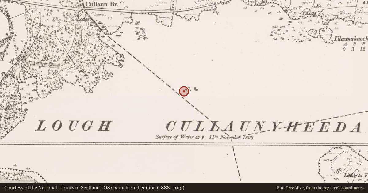
Off-centre to NW of Lough Cullaunyheeda, c. 320m from the shoreline at NW. Initially noted by the Discovery Programme in 2001 during analysis of aerial photography and described as a ‘stone built platform’. Depicted on the 25-inch OS map and 1921 edition OS 6-inch map as an isolated cluster of rock outcrop and on modern OS mapping as a small, roughly circular island (c. 20.5m N-S; c. 21m E-W). Not accessible during 2017 survey due to high water levels. A small cluster of limestones were noted protruding just above the water level at this location. These were further highlighted by a tree and enclosed to W and N by reeds.
The following images have been uploaded:
CL035-147----_01.jpg From N. View of crannog in Lough Cullaunyheeda.
CL035-147----_02.jpg From N. View of crannog showing limestone construction.
CL035-147----_03.jpg From NW. View of crannog and reeds.
Compiled by: Mary Tunney, Alison McQueen and Vera Rahilly
Date of upload: 18 January 2018
Nearby in the register
- Ritual site - holy wellunder 1 mi
- Fulacht fiaunder 1 mi
- Fulacht fiaunder 1 mi
- Fulacht fiaunder 1 mi
Other entries of the same register within about three miles of this one, by straight line.