Sites and Monuments Record · Ireland
Church
Inishcaltra Or Holy Island, County Clare, Ireland
The record
- Townland
- Inishcaltra Or Holy Island
- County
- Clare
- Country
- Ireland
- First-edition OS map
- Not indicated
- Latest-edition OS map
- Not indicated
- Coordinates
- 52.91538, -8.44890
- SMR number
- CL029-009139-
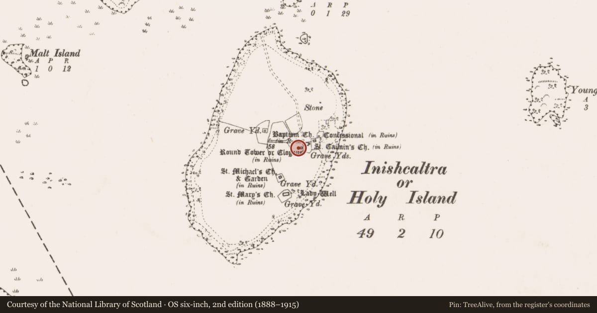
Slide toward Today to fade the historical sheet and see the modern map underneath.
David Rumsey Map Collection, Stanford LibrariesDavid Rumsey Map Collection, Stanford LibrariesDavid Rumsey Map Collection, Stanford LibrariesDavid Rumsey Map Collection, Stanford Libraries
4 historical maps cover this location, the earliest the 1790 map "Composite: Ireland." (David Rumsey Map Collection, Stanford Libraries).
Historical maps covering this location
- 1790 · Composite: Ireland. (David Rumsey Map Collection, Stanford Libraries)
- 1811 · Ireland. (David Rumsey Map Collection, Stanford Libraries)
- 1869 · Ireland. (David Rumsey Map Collection, Stanford Libraries)
- 1891 · Ireland 16 (David Rumsey Map Collection, Stanford Libraries)
This record in the National Monuments Service's Historic Environment Viewer ↗
The National Monuments Service's description
Situated c. 18m WSW of the round tower on Inis Cealtra. An earthen church was excavated here in 1974 (de Paor 2013, 40-41, 58). A rectangular building, rebuilt a number of times on slightly different orientations. The earliest phase of building (5.5m x 4.1m) was orientated exactly the same as St. Brigid’s church (CL029-009006-) and had a trodden clay floor. The walls (T over 2.5m) were defined by rows of wattle- or stake-holes and there was an entrance in the W wall. Close-set wattles appear to have been used as internal reinforcement. Rebuildings altered the orientation, first to almost NE-SW and then closer to E-W. This church, according to de Paor, represents the early phase of the monastery. The church was cut by a medieval house (CL029-009138-).
Compiled by: Mary Tunney
Date of upload: 9 November 2015
References
de Paor †, L. 2013 Inis Cealtra: Archaeological investigations of the monuments on the island. North Munster Antiquarian Journal 53, 27-78.
Nearby in the register
- Cross - High crossunder 1 mi
- House - medievalunder 1 mi
- Penitential stationunder 1 mi
- Excavation - miscellaneousunder 1 mi
Other entries of the same register within about three miles of this one, by straight line.