Sites and Monuments Record · Ireland
Children's burial ground
Glendree, County Clare, Ireland
The record
- Townland
- Glendree
- County
- Clare
- Country
- Ireland
- First-edition OS map
- Grave Yard
- Latest-edition OS map
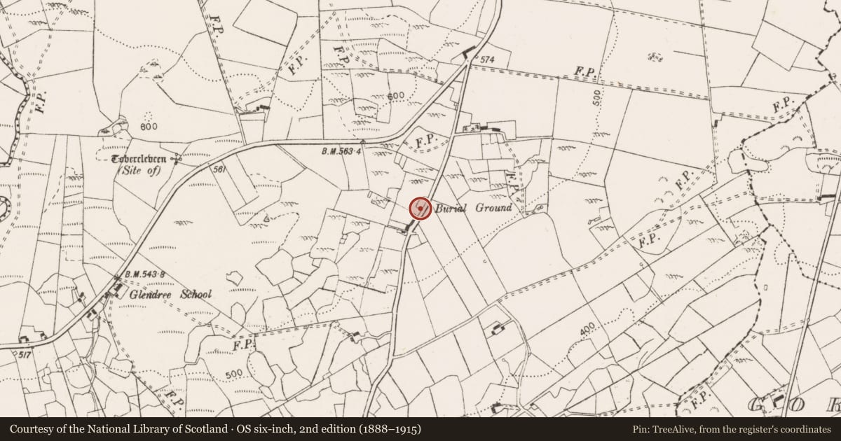
- Burial Ground (1920)
- Coordinates
- 52.92212, -8.71502
- SMR number
- CL027-003----
Slide toward Today to fade the historical sheet and see the modern map underneath.
David Rumsey Map Collection, Stanford LibrariesDavid Rumsey Map Collection, Stanford LibrariesDavid Rumsey Map Collection, Stanford LibrariesDavid Rumsey Map Collection, Stanford Libraries
4 historical maps cover this location, the earliest the 1753 map "Mappa geographica Regni Hiberniae" (David Rumsey Map Collection, Stanford Libraries).
Historical maps covering this location
- 1753 · Mappa geographica Regni Hiberniae (David Rumsey Map Collection, Stanford Libraries)
- 1790 · Composite: Ireland. (David Rumsey Map Collection, Stanford Libraries)
- 1869 · Ireland. (David Rumsey Map Collection, Stanford Libraries)
- 1891 · Ireland 16 (David Rumsey Map Collection, Stanford Libraries)
This record in the National Monuments Service's Historic Environment Viewer ↗
The National Monuments Service's description
On top of a low ridge, in pasture overlooking lower ground N-SW and overlooked by higher ground SW-N. A tertiary road (long-axis NE-SW) abuts the SE side. It is depicted and named ‘Grave Yard’ on 1842 edition of the OS 6-inch map and ‘Burial Ground’ on the OS 25-inch and 1920 edition of the OS 6-inch map. It consists of a rectangular area (25m NE-SW; 12m NW-SE) with a slight indent in the N corner and is defined by a revetment of small and large moss-covered boulders, some laid prostrate and others haphazardly.
The interior is covered in small, low, moss-covered stones, a significant number of which are notably upright E-facing gravemarkers. Some very small, well-defined graves are likely to mark infant burials. A curious rectangular area (1.9m NE-SW, 1.5m NW-SE) is located in the SW corner of the burial ground. It is defined by a row of three uprights to NW and two to SE and other small stones forming a kerb all around filling the gaps between the uprights and along the NE and SW sides. A long upright, E-facing slab (1.2m N-S; T 0.13m; H 0.2m) is located c. 1m to N and probably marks a separate burial. Another small grave (1.15m E-W; 0.9m N-S max. H 0.3m) is located c. 3m to NE. It is defined by two head stones and two foot stones to E and W and a kerb of lower stones on the other opposing sides. A semi-circular arrangement (6.5m NE-SW; 2.8m NW-SE) of kerbstones is located abutting the NW side halfway along the graveyard. Another obvious arrangement of stones c. 1.5m to E marks another probable burial and has uprights with flat flagstones across the surface. Other uprights are evident across the E and N side of the burial ground, including a large almost hogbacked boulder (1.75m NE-SW; 0.45m NW-SE; H 0.4m) in the NE corner. The perimeter of the graveyard is planted with a single line of conifers, except at the SW end and some thorn trees grow within the interior.
The following images have been uploaded:
CL027-003----_01.jpg From SW. General view of monument.
CL027-003----_02.jpg From SW. General view across interior.
CL027-003----_03.jpg From SE. Upright stones in NE area of graveyard.
CL027-003----_04.jpg From SE. Cross-sectional view of scarp, with kerb of stones, at NE.
CL027-003----_05.jpg From NW. Large sub-rectangular stone located at NE-end of graveyard.
Compiled by: Mary Tunney, Alison McQueen and Vera Rahilly
Date of upload: 28 November 2018
Nearby in the register
- Ritual site - holy wellunder 1 mi
- Moundunder 1 mi
- Enclosureunder 1 mi
- Water mill - unclassified1 mi
Other entries of the same register within about three miles of this one, by straight line.