Sites and Monuments Record · Ireland
House - 17th century
Ballymulqueeny, County Clare, Ireland
The record
- Townland
- Ballymulqueeny
- County
- Clare
- Country
- Ireland
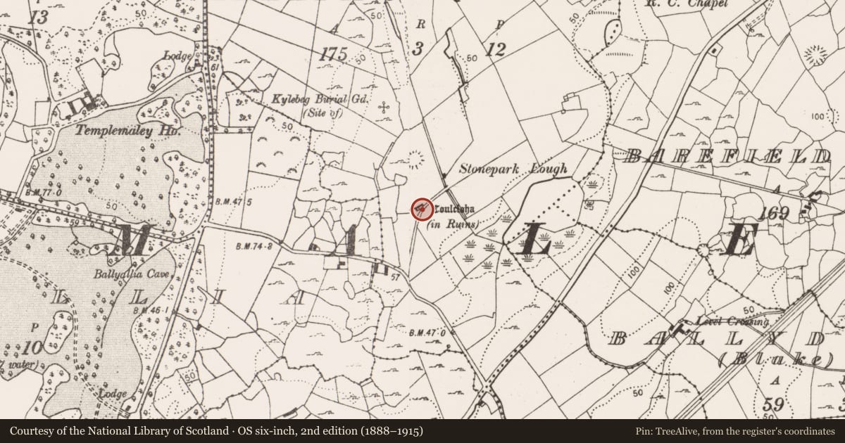
- First-edition OS map
- Coulclocha (in ruins)
- Latest-edition OS map
- Coulcloha (in Ruins) (1920)
- Coordinates
- 52.88331, -8.95929
- SMR number
- CL026-075----
Slide toward Today to fade the historical sheet and see the modern map underneath.
David Rumsey Map Collection, Stanford LibrariesDavid Rumsey Map Collection, Stanford LibrariesDavid Rumsey Map Collection, Stanford LibrariesDavid Rumsey Map Collection, Stanford Libraries
4 historical maps cover this location, the earliest the 1753 map "Mappa geographica Regni Hiberniae" (David Rumsey Map Collection, Stanford Libraries).
Historical maps covering this location
- 1753 · Mappa geographica Regni Hiberniae (David Rumsey Map Collection, Stanford Libraries)
- 1790 · Composite: Ireland. (David Rumsey Map Collection, Stanford Libraries)
- 1869 · Ireland. (David Rumsey Map Collection, Stanford Libraries)
- 1891 · Ireland 16 (David Rumsey Map Collection, Stanford Libraries)
This record in the National Monuments Service's Historic Environment Viewer ↗
The National Monuments Service's description
Situated on a gentle E-facing slope on the N side of an E-W laneway at a point where it turns S. Indicated and named 'Coulcloha (in ruins)' on both the 1840 and 1920 eds. of the OS 6-inch map, an anglicization of 'Cabhail Clocha' meaning 'Stone Ruin'. A five-bay two-storey house with attic (ext. dims. 15.05m ENE-WSW; 8.05m NNW-SSE) built of erratically coursed rubble field stones set in strong lime mortar with massive rough quoins on the corners (wall T 0.6m). The front (or SE) wall is not extant but the rear and gable walls survive to two storeys. An inserted cross-wall divides the house into two chambers, and because it is dug into the slope the W chamber at the ground floor has no surviving windows or doors. At the first floor there may have been five windows on the N wall and there were fireplaces on the E and W gables. Splayed, tall, narrow openings survive on the rear wall. The house is likely to date to around the late 17th century. (pers. comm. Risteard Ua Cróinín, Feb. 2008)
Compiled by: Michael Moore and Mary Tunney
Date of upload: 5 December 2016
Nearby in the register
- Ringfort - cashelunder 1 mi
- Children's burial groundunder 1 mi
- Enclosureunder 1 mi
- Souterrainunder 1 mi
Other entries of the same register within about three miles of this one, by straight line.