Sites and Monuments Record · Ireland
Children's burial ground
Killian, County Clare, Ireland
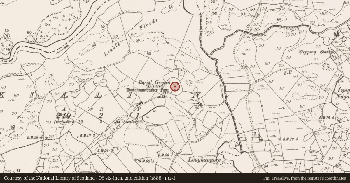
The record
- Townland
- Killian
- County
- Clare
- Country
- Ireland
- First-edition OS map
- Burial Ground
- Latest-edition OS map
- Childrens Burial Ground (Disused)(1920)
- Coordinates
- 52.91852, -8.94625
- SMR number
- CL026-003002-
Slide toward Today to fade the historical sheet and see the modern map underneath.
David Rumsey Map Collection, Stanford LibrariesDavid Rumsey Map Collection, Stanford LibrariesDavid Rumsey Map Collection, Stanford LibrariesDavid Rumsey Map Collection, Stanford Libraries
4 historical maps cover this location, the earliest the 1753 map "Mappa geographica Regni Hiberniae" (David Rumsey Map Collection, Stanford Libraries).
Historical maps covering this location
- 1753 · Mappa geographica Regni Hiberniae (David Rumsey Map Collection, Stanford Libraries)
- 1790 · Composite: Ireland. (David Rumsey Map Collection, Stanford Libraries)
- 1869 · Ireland. (David Rumsey Map Collection, Stanford Libraries)
- 1891 · Ireland 16 (David Rumsey Map Collection, Stanford Libraries)
This record in the National Monuments Service's Historic Environment Viewer ↗
The National Monuments Service's description
Situated just SE of the centre of an ecclesiastical enclosure (CL026-003001-). Named 'Children's Burial Ground (disused)' on the 1920 ed. of the OS 6-inch map and listed as 'Burial ground' in the RMP (1996). A rectangular overgrown area (int. dims. 30m E-W; 27m N-S; ext. dims. 42m E-W; 35m N-S) defined by a stone spread (Wth 3-4m; H 0.5-1m) with some facing stones at N (original Wth 1.4m). The entrance (Wth 1.5m) is towards the S end of the E side, and there is a cairn (CL026-003006-) (diam. 5m; H 0.7m) outside the perimeter at N, but there are no grave-markers. (O'Flanagan 1928, vol. 2, 48; MacMahon 1984, 17)
Compiled by: Michael Moore
Date of upload: 28 November 2016
References
MacMahon, M. 1984 The Doughnambraher font. The Other Clare 8, 17-18.
O'Flanagan, Rev. M. (Compiler) 1928 Letters containing information relative to the antiquities of the county of Clare collected during the progress of the Ordnance Survey in 1839. Typescript in 3 vols. Bray.
Nearby in the register
- Ecclesiastical enclosureunder 1 mi
- Churchunder 1 mi
- Cairn - unclassifiedunder 1 mi
- Bullaun stoneunder 1 mi
Other entries of the same register within about three miles of this one, by straight line.