Sites and Monuments Record · Ireland
Gateway
Parknabinnia, County Clare, Ireland
The record
- Townland
- Parknabinnia
- County
- Clare
- Country
- Ireland
- First-edition OS map
- Pillars
- Latest-edition OS map
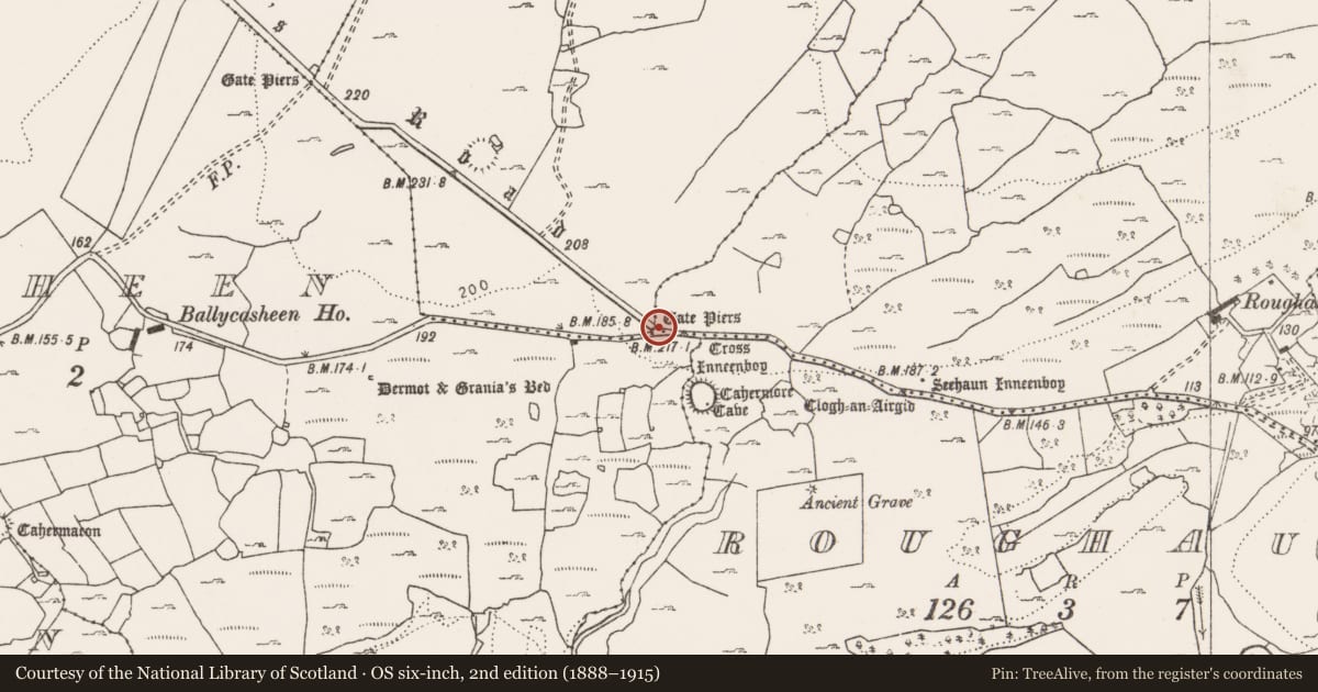
- Gate Piers (1916)
- Coordinates
- 52.97810, -9.11561
- SMR number
- CL016-050----
Slide toward Today to fade the historical sheet and see the modern map underneath.
David Rumsey Map Collection, Stanford LibrariesDavid Rumsey Map Collection, Stanford LibrariesDavid Rumsey Map Collection, Stanford LibrariesDavid Rumsey Map Collection, Stanford Libraries
4 historical maps cover this location, the earliest the 1753 map "Mappa geographica Regni Hiberniae" (David Rumsey Map Collection, Stanford Libraries).
Historical maps covering this location
- 1753 · Mappa geographica Regni Hiberniae (David Rumsey Map Collection, Stanford Libraries)
- 1790 · Composite: Ireland. (David Rumsey Map Collection, Stanford Libraries)
- 1869 · Ireland. (David Rumsey Map Collection, Stanford Libraries)
- 1891 · Ireland 16 (David Rumsey Map Collection, Stanford Libraries)
This record in the National Monuments Service's Historic Environment Viewer ↗
The National Monuments Service's description
On the Kilnaboy to Leamaneh road at a junction with a minor road to the W. Named ‘Pillars’ on the 1840 OS 6-inch map. Named ‘Gate Piers’ on the 1916 ed. and on the 1897 OS 25-inch map. Listed as ‘Gate piers’ in the RMP (1996). Described by Westropp (1900, 406-7) along with ‘Gate piers’ (CL016-045----) c. 550m to the NW as ‘the long walled avenue, with the piers of two other gateways’ ‘seen as we drive towards Corofin’.
On inspection in 1998 no gate piers were visible at this location. A cross and a tau cross (CL016-052004- and CL016-052002-) are located c. 57m to the SE. A cashel and souterrain (CL016-052001- and CL016-052003-) are located c. 87m to the SSE.
Compiled by: Mary Tunney and Lynda McCormack
Date of upload: 10 May 2022
References
Westropp, T.J. 1900 Excursions of the Royal Society of Antiquaries of Ireland, Summer meeting, 1900. Description of the places visited. Section III. Third excursion; Section IV. Fourth Excursion. Journal of the Royal Society of Antiquaries of Ireland 10, 392-419; 420-26.
Nearby in the register
- Cross - Tau crossunder 1 mi
- Crossunder 1 mi
- Ringfort - cashelunder 1 mi
- Souterrainunder 1 mi
Other entries of the same register within about three miles of this one, by straight line.