Sites and Monuments Record · Ireland
Barrow - ring-barrow
Leamaneh South, County Clare, Ireland
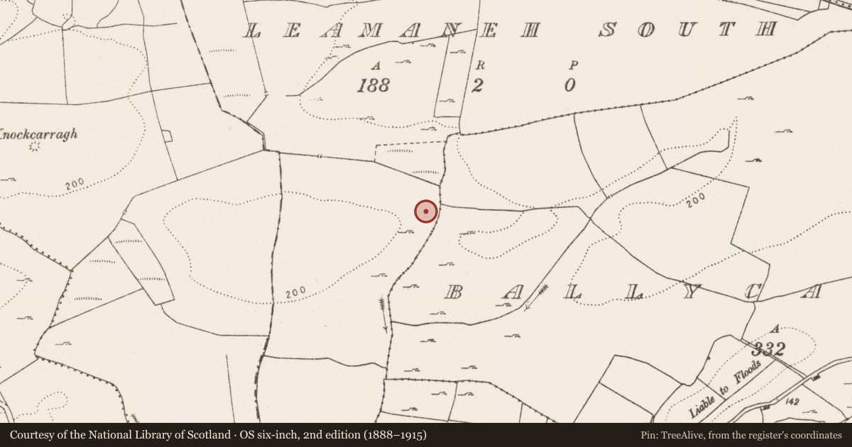
The record
- Townland
- Leamaneh South
- County
- Clare
- Country
- Ireland
- First-edition OS map
- Hachured
- Latest-edition OS map
- Hachured (1916)
- Coordinates
- 52.98003, -9.14294
- SMR number
- CL016-030----
Slide toward Today to fade the historical sheet and see the modern map underneath.
David Rumsey Map Collection, Stanford LibrariesDavid Rumsey Map Collection, Stanford LibrariesDavid Rumsey Map Collection, Stanford LibrariesDavid Rumsey Map Collection, Stanford Libraries
4 historical maps cover this location, the earliest the 1753 map "Mappa geographica Regni Hiberniae" (David Rumsey Map Collection, Stanford Libraries).
Historical maps covering this location
- 1753 · Mappa geographica Regni Hiberniae (David Rumsey Map Collection, Stanford Libraries)
- 1790 · Composite: Ireland. (David Rumsey Map Collection, Stanford Libraries)
- 1869 · Ireland. (David Rumsey Map Collection, Stanford Libraries)
- 1891 · Ireland 16 (David Rumsey Map Collection, Stanford Libraries)
This record in the National Monuments Service's Historic Environment Viewer ↗
The National Monuments Service's description
On a knoll, near the bottom of an E-facing slope overlooking a N-S stream with high ground to the E. The views are limited but another barrow (CL016-029----) is visible c. 800m to the W. Hachured on the 1840 and 1916 OS 6-inch maps. Listed as ‘ring-barrow (possible)’ in the RMP (1996).
A poorly preserved ring-barrow (20.4m NW-SE; 20m NE-SW) comprising a low subrectangular mound (8.9m NW-SE; 5.1m NE-SW) with slightly raised edges surrounded by a slight but continuous fosse (Wth 1-4m) and an outer bank (Wth 4.4-6m; int. H 0.1-0.3m; ext. H 0.3-1.3m) from NE to S. The bank is highest (1.3m) from E-SE where it merges with the natural slope. A large limestone boulder (L 1.7m; Wth 0.9m; T 0.5m) sits on the projected line of the bank at SW and another possible vestige of the bank is visible at WNW. A gap in the bank at SW (Wth 6.3m) may be an original entrance. The barrow has been cut by field drains at W and N.
Compiled by: Mary Tunney and Lynda McCormack
Date of upload: 11 May 2022
Nearby in the register
- Enclosureunder 1 mi
- Gatewayunder 1 mi
- Ringfort - rathunder 1 mi
- Barrow - unclassifiedunder 1 mi
Other entries of the same register within about three miles of this one, by straight line.