Sites and Monuments Record · Ireland
Graveslab
Kilfenora, County Clare, Ireland
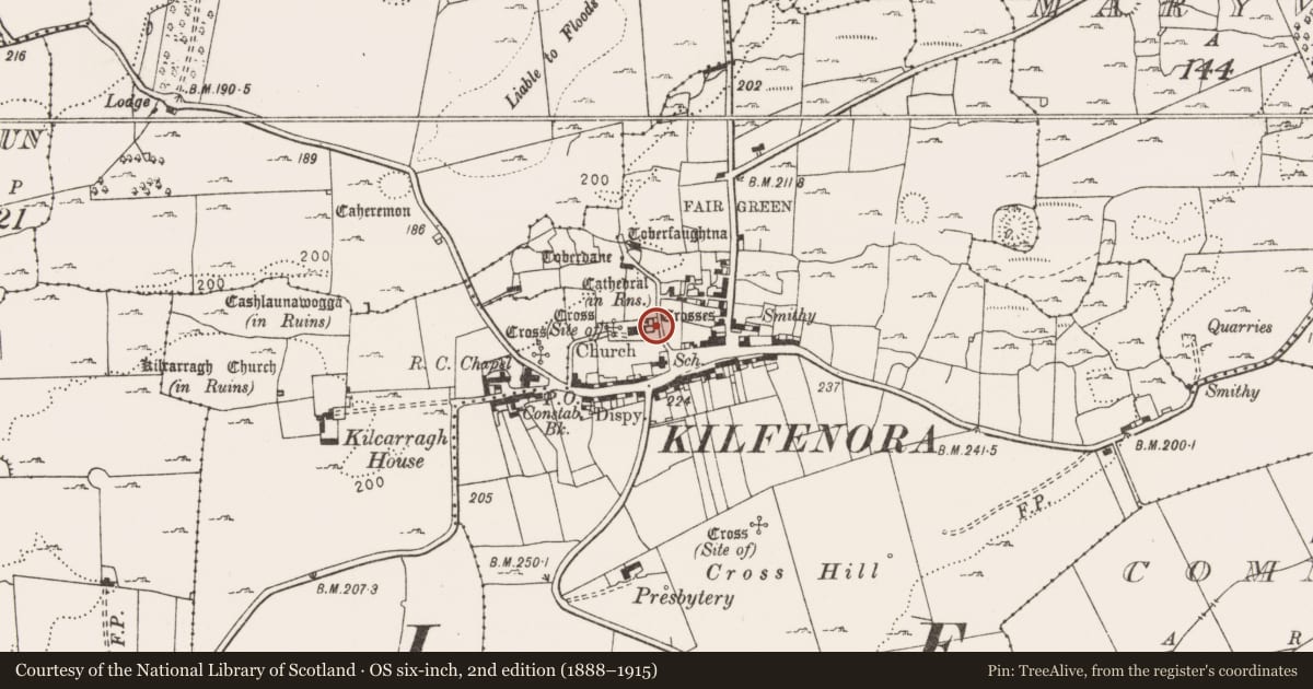
The record
- Townland
- Kilfenora
- County
- Clare
- Country
- Ireland
- First-edition OS map
- Not indicated
- Latest-edition OS map
- Not indicated
- Coordinates
- 52.99068, -9.21677
- SMR number
- CL016-015020-
Slide toward Today to fade the historical sheet and see the modern map underneath.
David Rumsey Map Collection, Stanford LibrariesDavid Rumsey Map Collection, Stanford LibrariesDavid Rumsey Map Collection, Stanford LibrariesDavid Rumsey Map Collection, Stanford Libraries
4 historical maps cover this location, the earliest the 1753 map "Mappa geographica Regni Hiberniae" (David Rumsey Map Collection, Stanford Libraries).
Historical maps covering this location
- 1753 · Mappa geographica Regni Hiberniae (David Rumsey Map Collection, Stanford Libraries)
- 1790 · Composite: Ireland. (David Rumsey Map Collection, Stanford Libraries)
- 1869 · Ireland. (David Rumsey Map Collection, Stanford Libraries)
- 1891 · Ireland 16 (David Rumsey Map Collection, Stanford Libraries)
This record in the National Monuments Service's Historic Environment Viewer ↗
The National Monuments Service's description
Situated in the NE corner of the chancel of Kilfenora cathedral (CL016-015002-). Not listed in the SMR (1992) or the RMP (1996). This is a rectangular graveslab lying recumbent (L 2.22m; Wth 0.74m). It is plain except for script in large plain capital letters incised all around the edge. The text reads 'HERE LYETH THE BODY OF HYGATELONE WHO LIVED 21 YEARES DEANE OF THIS CHURCH AND DIED IN SEPTEMBER 1638'. Some traces of decoration (well worn) are evident at the W end of the slab. A second medieval graveslab (CL016-015021-) lies nearby to SW. Some of the other rough slabs lying in the chancel may also be medieval in date. (Barry 1892, 40)
The following image has been uploaded:
CL016-015020-_01.jpg View of graveslab from N.
Compiled by: Mary Tunney
Date of upload: 29 August 2018
References
Barry, J.G. 1892 County Clare. Kilfenora Churchyard. Journal of the Association for the Preservation of the Memorials of the Dead in Ireland 2, 38-40.
Nearby in the register
- Wall monumentunder 1 mi
- Cathedralunder 1 mi
- Cross - High crossunder 1 mi
- Graveslabunder 1 mi
Other entries of the same register within about three miles of this one, by straight line.