Sites and Monuments Record · Ireland
Ringfort - rath
Knocknaraha, County Clare, Ireland
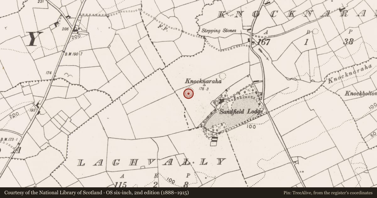
The record
- Townland
- Knocknaraha
- County
- Clare
- Country
- Ireland
- First-edition OS map
- Hachured
- Latest-edition OS map
- Hachured (1916)
- Coordinates
- 52.95512, -9.36764
- SMR number
- CL015-044----
Slide toward Today to fade the historical sheet and see the modern map underneath.
David Rumsey Map Collection, Stanford LibrariesDavid Rumsey Map Collection, Stanford LibrariesDavid Rumsey Map Collection, Stanford LibrariesDavid Rumsey Map Collection, Stanford Libraries
4 historical maps cover this location, the earliest the 1753 map "Mappa geographica Regni Hiberniae" (David Rumsey Map Collection, Stanford Libraries).
Historical maps covering this location
- 1753 · Mappa geographica Regni Hiberniae (David Rumsey Map Collection, Stanford Libraries)
- 1790 · Composite: Ireland. (David Rumsey Map Collection, Stanford Libraries)
- 1869 · Ireland. (David Rumsey Map Collection, Stanford Libraries)
- 1891 · Ireland 16 (David Rumsey Map Collection, Stanford Libraries)
This record in the National Monuments Service's Historic Environment Viewer ↗
The National Monuments Service's description
In marshy pasture on the summit of a ridge aligned WSW-ENE with panoramic views, flanked by a modern farm road to the N. Hachured on the 1840 and 1916 OS 6-inch maps. Listed as 'Enclosure' in the RMP (1996). A bivallate circular rath (max. ext. diam. c. 60m) defined by a bank, a fosse and an outer bank. The bank (int. H 0.2–0.9m; ext. H 1.4–1.6m; Wth 5m) is composed of stone and earth with traces of stone facing along its interior at E and NW, and is concealed by gorse at E, SW, and W. The fosse is flat-bottomed (Wth at base c. 2.2m; Wth at top c. 8m; ext. D 0.25m) and has been reduced to field level at NW. The outer bank (Wth 3.1m; H 0.1m) is traceable at SW and NNW; it is surmounted by a field boundary at N and is concealed by vegetation at E. A slight lowering of the inner bank (Wth 2.9m) at SSW correlating with a causeway across the fosse may represent an original entrance. The interior of the monument undulates gently and is covered in rushes. A house site (CL015-044002-) is located in the centre of the rath.
Compiled by: Mary Tunney and Eve Campbell
Date of upload: 10 July 2023
Nearby in the register
- House - indeterminate dateunder 1 mi
- Ringfort - rathunder 1 mi
- Ringfort - rathunder 1 mi
- Ringfort - rathunder 1 mi
Other entries of the same register within about three miles of this one, by straight line.