Sites and Monuments Record · Ireland
Children's burial ground
Derreen (Ballysteen ED), County Clare, Ireland
The record
- Townland
- Derreen (Ballysteen ED)
- County
- Clare
- Country
- Ireland
- First-edition OS map
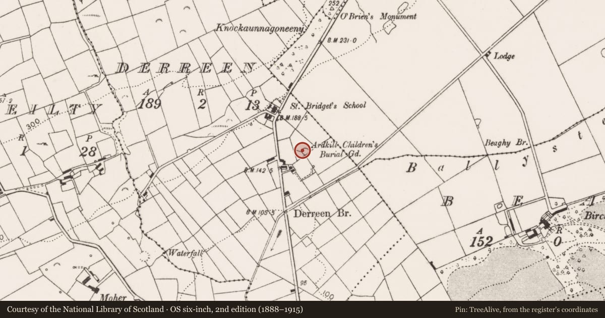
- Ardkill Childrens Burial Ground
- Latest-edition OS map
- Ardkill Childrens Burial Gd (1916)
- Coordinates
- 52.94810, -9.42410
- SMR number
- CL014-020----
Slide toward Today to fade the historical sheet and see the modern map underneath.
David Rumsey Map Collection, Stanford LibrariesDavid Rumsey Map Collection, Stanford LibrariesDavid Rumsey Map Collection, Stanford LibrariesDavid Rumsey Map Collection, Stanford Libraries
4 historical maps cover this location, the earliest the 1753 map "Mappa geographica Regni Hiberniae" (David Rumsey Map Collection, Stanford Libraries).
Historical maps covering this location
- 1753 · Mappa geographica Regni Hiberniae (David Rumsey Map Collection, Stanford Libraries)
- 1790 · Composite: Ireland. (David Rumsey Map Collection, Stanford Libraries)
- 1869 · Ireland. (David Rumsey Map Collection, Stanford Libraries)
- 1891 · Ireland 16 (David Rumsey Map Collection, Stanford Libraries)
This record in the National Monuments Service's Historic Environment Viewer ↗
The National Monuments Service's description
On a SE-facing slope in pasture, offering wide views. Hachured and named ‘Ardkill Children’s Burial Ground’ on first (1842) and Cassini (1920) editions of the OS 6-inch map. Listed as ‘Burial ground’ in the RMP (1996). This subcircular children’s burial ground (int. diam. 16m) is defined by a modern stone wall (int. H 1m; ext. H 1.5-2m) with vertical coping. There is a gate and stile at the SSE. Eight graves are visible in the grass-covered interior of the burial ground, marked by horizontal graveslabs. Another grave is visible in outline, just W of the centre where there is a cut-stone cross (H 1.5m) on a circular plinth incorporating steps on the E side. This monument has been said to mark the grave of a 12 year-old daughter of local landlord Cornelius O’Brien (1782-1857). There are also two modern headstones dated 1965 and 1976. In the E of the burial ground are four roughly parallel E-W running grass-covered collapsed walls. The SW quadrant has been levelled and cleared.
Compiled by: Gearoid Conroy and Conn Herriott
Date of upload: 6-10-2015
Nearby in the register
- Ritual site - holy wellunder 1 mi
- Ringfort - rathunder 1 mi
- Burial groundunder 1 mi
- Ringfort - rathunder 1 mi
Other entries of the same register within about three miles of this one, by straight line.