Sites and Monuments Record · Ireland
Penitential station
Ballyshanny, County Clare, Ireland
The record
- Townland
- Ballyshanny
- County
- Clare
- Country
- Ireland
- First-edition OS map
- Not indicated
- Latest-edition OS map
- Not indicated
- Coordinates
- 52.99667, -9.21352
- SMR number
- CL009-092002-
Slide toward Today to fade the historical sheet and see the modern map underneath.
David Rumsey Map Collection, Stanford LibrariesDavid Rumsey Map Collection, Stanford LibrariesDavid Rumsey Map Collection, Stanford LibrariesDavid Rumsey Map Collection, Stanford Libraries
4 historical maps cover this location, the earliest the 1753 map "Mappa geographica Regni Hiberniae" (David Rumsey Map Collection, Stanford Libraries).
Historical maps covering this location
- 1753 · Mappa geographica Regni Hiberniae (David Rumsey Map Collection, Stanford Libraries)
- 1790 · Composite: Ireland. (David Rumsey Map Collection, Stanford Libraries)
- 1869 · Ireland. (David Rumsey Map Collection, Stanford Libraries)
- 1891 · Ireland 16 (David Rumsey Map Collection, Stanford Libraries)
This record in the National Monuments Service's Historic Environment Viewer ↗
The National Monuments Service's description
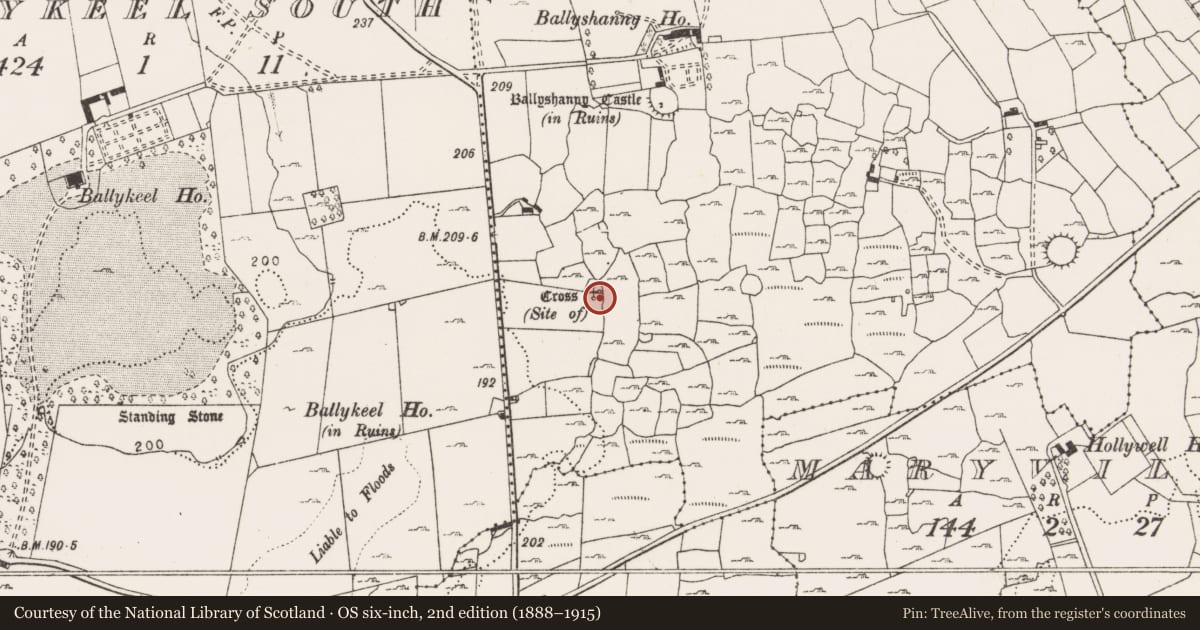
On a low knoll in pasture, within a large multiperiod field system (CL009-059001-). This subcircular penitential station (6.5m N-S; 5m E-W; H 0.9m) is composed of a loose tumble of large unworked stones and smaller blocks with small moss-covered stones at the centre. No kerbing or revetting stones are evident. It is possible that it is the ‘heap of stones’ noted by Kaftannikov (1953-1957, 30), which surrounded the well-cut socket stone of a cross (CL009-092----). Alternatively, a very small circular area (diam. 2.7m) at the highest point of the knoll, 7.5m to the NE, may be it. The latter is defined by large unworked grass-covered blocks (av. L 0.5m; Wth 0.2m; H 0.4m) set on edge as a kerb/retaining wall and the interior is filled with loose stones. This may have been a wall/plinth/socket for the cross.
Compiled by: Olive Alcock and Conn Herriott
Date of upload: 31 May 2022
References
Kaftannikov, L. 1953-1957 The high crosses of Kilfenora. North Munster Antiquarian Journal 7, 29-30.
Nearby in the register
- Crossunder 1 mi
- Hut siteunder 1 mi
- Ringfort - cashelunder 1 mi
- Castle - tower houseunder 1 mi
Other entries of the same register within about three miles of this one, by straight line.