Sites and Monuments Record · Ireland
Megalithic structure
Ballyganner North, County Clare, Ireland
The record
- Townland
- Ballyganner North
- County
- Clare
- Country
- Ireland
- First-edition OS map
- Not indicated
- Latest-edition OS map
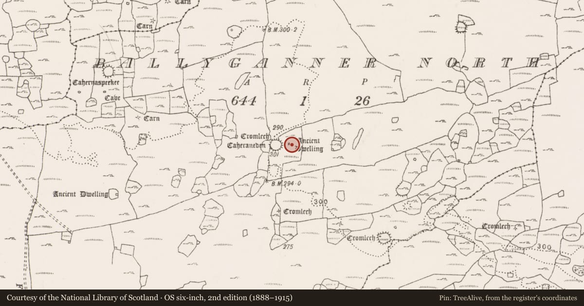
- Ancient Dwelling (1916)
- Coordinates
- 53.00598, -9.16140
- SMR number
- CL009-059068-
Slide toward Today to fade the historical sheet and see the modern map underneath.
David Rumsey Map Collection, Stanford LibrariesDavid Rumsey Map Collection, Stanford LibrariesDavid Rumsey Map Collection, Stanford LibrariesDavid Rumsey Map Collection, Stanford Libraries
4 historical maps cover this location, the earliest the 1753 map "Mappa geographica Regni Hiberniae" (David Rumsey Map Collection, Stanford Libraries).
Historical maps covering this location
- 1753 · Mappa geographica Regni Hiberniae (David Rumsey Map Collection, Stanford Libraries)
- 1790 · Composite: Ireland. (David Rumsey Map Collection, Stanford Libraries)
- 1869 · Ireland. (David Rumsey Map Collection, Stanford Libraries)
- 1891 · Ireland 16 (David Rumsey Map Collection, Stanford Libraries)
This record in the National Monuments Service's Historic Environment Viewer ↗
The National Monuments Service's description
At the W edge of a gently W-sloping limestone pavement, with a broad ravine c. 50m to W and N. Within a large multiperiod field system (CL009-059001-). Indicated and labelled ‘Ancient Dwelling’ on the OS 25-inch plan (1897) and 1920 ed. of the OS 6-inch map. This rectangular structure (int. dims. 3.2m NNE-SSW; 2.7m WNW-ESE) is defined at N, E and S by upright limestone slabs (H 0.3-0.8m; Wth 0.2-0.3m). The E wall is set in a gryke. The structure has no W side, or fragments thereof (Westropp 1897, 120). A higher stone (H 1.05m) in the S wall has a pointed top. At the W end of the N side there are two further upright slabs (H 0.35-0.6m; Wth 0.5-0.8m) outside the main structure, forming the E and N sides of a small cist-like space (0.8m NNE-SSW; c. 0.5m WNW-ESE) which appears to have been enclosed on all sides when visited by Westropp (1901, 290).
A cashel (CL009-059066-) lies c. 22m to the W, a court tomb (CL009-059063-) lies c. 154m to the WNW and a wedge tomb (CL009-059069-) lies c. 202m to the S.
The following image has been uploaded:
CL009-059058-_01.jpg View of possible megalithic structure from SW
Compiled by: Mary Tunney and Conn Herriott
Date of upload: 30 March 2022
References
Westropp, T.J. 1897 Prehistoric stone forts of northern Clare, part III. Journal of the Royal Society of Antiquaries 27, 116-27.
Westropp, T.J 1901 Prehistoric remains in north-western Clare part II. Journal of the Royal Society of Antiquaries of Ireland 31, 273-91.
Nearby in the register
- Ringfort - cashelunder 1 mi
- Megalithic tomb - court tombunder 1 mi
- Megalithic tomb - wedge tombunder 1 mi
- Enclosureunder 1 mi
Other entries of the same register within about three miles of this one, by straight line.