Sites and Monuments Record · Ireland
Cross
Noughaval (Burren By.), County Clare, Ireland
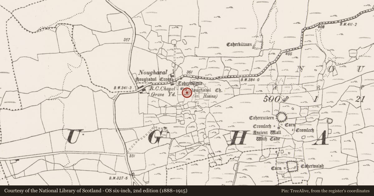
The record
- Townland
- Noughaval (Burren By.)
- County
- Clare
- Country
- Ireland
- First-edition OS map
- Not indicated
- Latest-edition OS map
- Not indicated
- Coordinates
- 53.01567, -9.18019
- SMR number
- CL009-059028-
Slide toward Today to fade the historical sheet and see the modern map underneath.
David Rumsey Map Collection, Stanford LibrariesDavid Rumsey Map Collection, Stanford LibrariesDavid Rumsey Map Collection, Stanford LibrariesDavid Rumsey Map Collection, Stanford Libraries
4 historical maps cover this location, the earliest the 1753 map "Mappa geographica Regni Hiberniae" (David Rumsey Map Collection, Stanford Libraries).
Historical maps covering this location
- 1753 · Mappa geographica Regni Hiberniae (David Rumsey Map Collection, Stanford Libraries)
- 1790 · Composite: Ireland. (David Rumsey Map Collection, Stanford Libraries)
- 1869 · Ireland. (David Rumsey Map Collection, Stanford Libraries)
- 1891 · Ireland 16 (David Rumsey Map Collection, Stanford Libraries)
This record in the National Monuments Service's Historic Environment Viewer ↗
The National Monuments Service's description
Within a graveyard (CL009-059024-) to the S of a medieval church (CL009-059023-) and to the W of a chapel (CL009-059027-). Noted by Westropp (1909, 25) a ‘curious Celtic cross’. Harbison (1992, vol. 1, 158) describes it as a ringed limestone cross (H above ground 1.18m; arm Wth 0.67m; T 0.1m) with traces of roll mouldings at the edges. The ring segments do not form a perfect circle and the armpits are small and rounded. Traces of a circular decoration at the centre of the head on the W face may have borne interlace decoration. There is another set of circles beneath it. The E face appears to be undecorated. The shaft of the cross is set in a hole in a raised slab of limestone, which forms the top of a leacht (CL009-059120-). The cross probably dates to the 12th or early 13th century (ibid.). (Large 2011)
The following image has been uploaded: CL009-059028-_01.jpg W face of cross
Compiled by: Olive Alcock and Conn Herriott
Date of upload: 30 March 2022
References
Large, S. 2011 A church and graveyard survey in County Clare. Database and photographic record. Clare County Council. Clare Heritage Forum. The Heritage Council.
Harbison, P. 1992 The high crosses of Ireland: an iconographical and photographic survey, 3 vols. Dublin. Royal Irish Academy. Bonn. Dr. Rudolf Habelt GMBH.
Westropp T.J. 1909 Notes on the antiquities around Kilfenora and Lehinch, Co. Clare, Part 1. North Munster Antiquarian Journal 1, 14-29.
Nearby in the register
Other entries of the same register within about three miles of this one, by straight line.