Sites and Monuments Record · Ireland
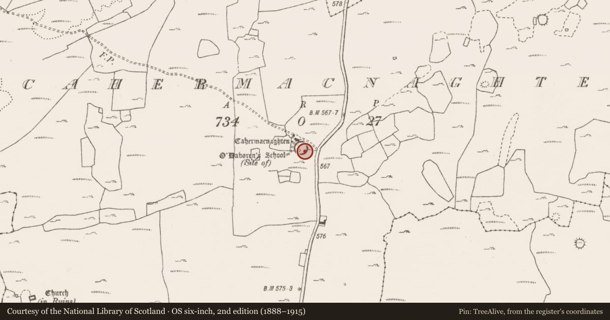
House - 16th century
Cahermacnaghten, County Clare, Ireland
The record
- Townland
- Cahermacnaghten
- County
- Clare
- Country
- Ireland
- First-edition OS map
- Not indicated
- Latest-edition OS map
- Not indicated
- Coordinates
- 53.04589, -9.19830
- SMR number
- CL009-001052-
Slide toward Today to fade the historical sheet and see the modern map underneath.
David Rumsey Map Collection, Stanford LibrariesDavid Rumsey Map Collection, Stanford LibrariesDavid Rumsey Map Collection, Stanford LibrariesDavid Rumsey Map Collection, Stanford Libraries
4 historical maps cover this location, the earliest the 1753 map "Mappa geographica Regni Hiberniae" (David Rumsey Map Collection, Stanford Libraries).
Historical maps covering this location
- 1753 · Mappa geographica Regni Hiberniae (David Rumsey Map Collection, Stanford Libraries)
- 1790 · Composite: Ireland. (David Rumsey Map Collection, Stanford Libraries)
- 1869 · Ireland. (David Rumsey Map Collection, Stanford Libraries)
- 1891 · Ireland 16 (David Rumsey Map Collection, Stanford Libraries)
This record in the National Monuments Service's Historic Environment Viewer ↗
The National Monuments Service's description
Mentioned as a ‘tighe móir’ in a deed of 1606 this house lies just S of the entrance to Cahermacnaghten cashel (CL009-001010-). A long rectangular structure (ext. dims. 11m x 6.2m). The S wall and E gable appear to run into the cashel wall itself. The dimensions of this house are comparable to what is regarded as the principal house of the cashel (CL009-001012-) to the W. The foundations of three other houses (CL009-001049-, CL009-001050- and CL009-001051-) can be made out inside the cashel wall at N and W. FitzPatrick (2008, 62) The houses within the cashel were divided between Aodh and Cosnamhach Ó Dabhoireann in 1606 and the deed also mentions that the houses had been the property of their grandfather (FitzPatrick 2008, 59). Caher Mhic Neachtain is a National Monument in State Care, no. 354.
Compiled by: Mary Tunney
Date of upload: 17 July 2018
References
Fitzpatrick, E. 2008 Antiquarian scholarship and the archaeology of Cahermacnaghten, Burren, Co. Clare. The Other Clare 32, 58-66.
Nearby in the register
- Ringfort - cashelunder 1 mi
- Schoolunder 1 mi
- House - 16th centuryunder 1 mi
- House - 16th centuryunder 1 mi
Other entries of the same register within about three miles of this one, by straight line.