Sites and Monuments Record · Ireland
Ringfort - cashel
Ballyvoe (Corcomroe By.), County Clare, Ireland
The record
- Townland
- Ballyvoe (Corcomroe By.)
- County
- Clare
- Country
- Ireland
- First-edition OS map
- Not indicated
- Latest-edition OS map
- Not indicated
- Coordinates
- 53.03359, -9.37731
- SMR number
- CL008-007----
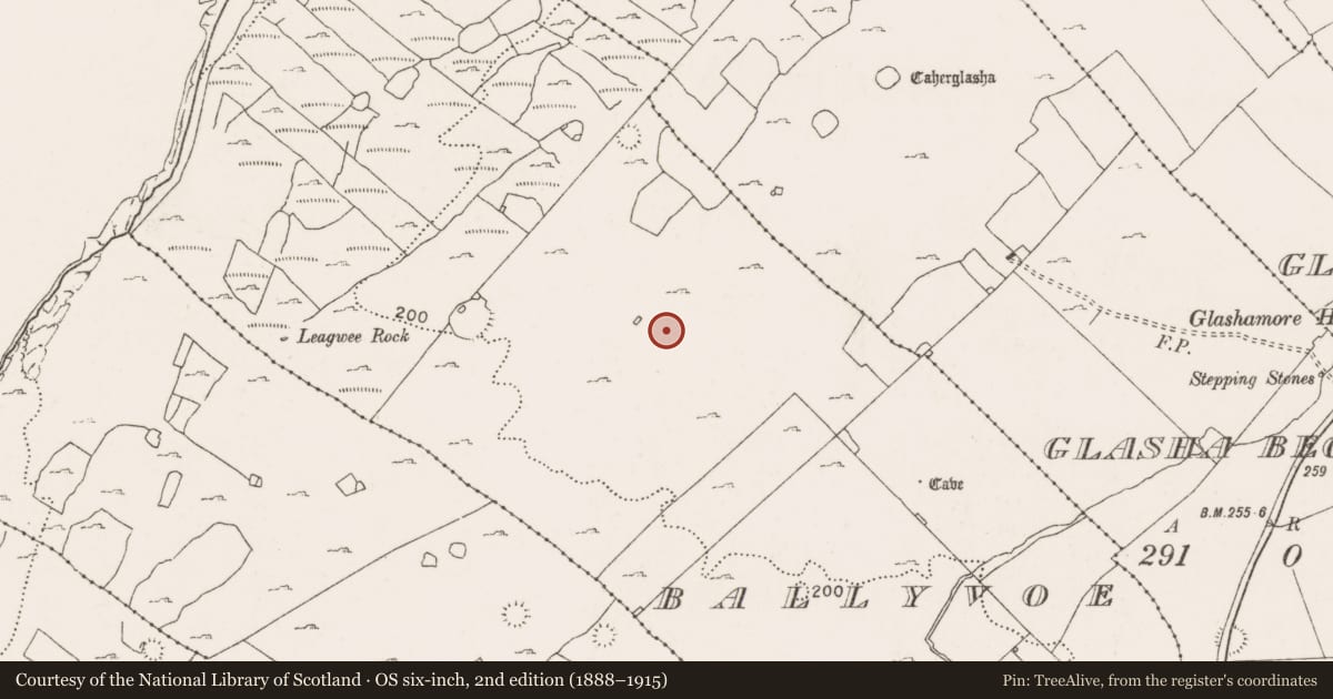
Slide toward Today to fade the historical sheet and see the modern map underneath.
David Rumsey Map Collection, Stanford LibrariesDavid Rumsey Map Collection, Stanford LibrariesDavid Rumsey Map Collection, Stanford LibrariesDavid Rumsey Map Collection, Stanford Libraries
4 historical maps cover this location, the earliest the 1753 map "Mappa geographica Regni Hiberniae" (David Rumsey Map Collection, Stanford Libraries).
Historical maps covering this location
- 1753 · Mappa geographica Regni Hiberniae (David Rumsey Map Collection, Stanford Libraries)
- 1790 · Composite: Ireland. (David Rumsey Map Collection, Stanford Libraries)
- 1869 · Ireland. (David Rumsey Map Collection, Stanford Libraries)
- 1891 · Ireland 16 (David Rumsey Map Collection, Stanford Libraries)
This record in the National Monuments Service's Historic Environment Viewer ↗
The National Monuments Service's description
Beside a disused bothán in a field of karstic limestone pavement and scrub within a relict field system (CL009-004001-) and a larger multiperiod field system (CL008-109001-). This may be the fort described by Westropp (1905, 357) as ‘Another fort of large blocks, but much broken’, which adjoined a ‘ruined cottage’. A possible cashel (int. diam. 22m N-S), subcircular in plan, is defined at E by an earth and stone bank (Wth 3m; int. H 0.5m; ext. H 0.85) which decreases in height toward N (ext. H 0.5m) and elsewhere is difficult to trace due to the natural slope of the ground. Intermittent limestone uprights, concentrated at N and S, may be the remains of an outer revetment. The raised interior (av. H 1m over exterior) is flat.
Compiled by: Olive Alcock and Conn Herriott
Date of upload: 18 August 2022
References
Westropp, T. J. 1905 Prehistoric remains (Forts and Dolmens) along the borders of Burren, in the county of Clare. Part 2 - west Corcomroe. Journal of the Royal Society of Antiquaries of Ireland, vol. 35, 342-61.
Nearby in the register
- Field systemunder 1 mi
- Enclosureunder 1 mi
- Enclosureunder 1 mi
- Enclosureunder 1 mi
Other entries of the same register within about three miles of this one, by straight line.