Sites and Monuments Record · Ireland
Ritual site - holy/saint's stone
Gragan West, County Clare, Ireland
The record
- Townland
- Gragan West
- County
- Clare
- Country
- Ireland
- First-edition OS map
- Not indicated
- Latest-edition OS map
- Not indicated
- Coordinates
- 53.06830, -9.19412
- SMR number
- CL005-168002-
Slide toward Today to fade the historical sheet and see the modern map underneath.
David Rumsey Map Collection, Stanford LibrariesDavid Rumsey Map Collection, Stanford LibrariesDavid Rumsey Map Collection, Stanford LibrariesDavid Rumsey Map Collection, Stanford Libraries
4 historical maps cover this location, the earliest the 1753 map "Mappa geographica Regni Hiberniae" (David Rumsey Map Collection, Stanford Libraries).
Historical maps covering this location
- 1753 · Mappa geographica Regni Hiberniae (David Rumsey Map Collection, Stanford Libraries)
- 1790 · Composite: Ireland. (David Rumsey Map Collection, Stanford Libraries)
- 1869 · Ireland. (David Rumsey Map Collection, Stanford Libraries)
- 1891 · Ireland 16 (David Rumsey Map Collection, Stanford Libraries)
This record in the National Monuments Service's Historic Environment Viewer ↗
The National Monuments Service's description
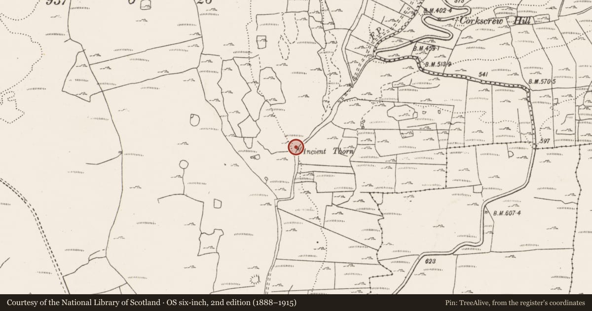
At the foot of a mature hawthorn tree (CL005-168001-) in reclaimed pasture on the W side of an old road leading N into the Rathborney valley. The associated tree is indicated and named ‘Ancient Thorn’ on the 1839 and 1916 OS 6-inch maps. Houlihan (2016, 44) noted that the associated tree is known locally as ‘Saint Brigid’s tree’ and that it is still visited by pilgrims, ‘having gained a reputation for holiness from a stone at its base thought by locals to hold the prints of a kneeling Saint Brigid’. The stone was not found on inspection in 1998 but a stone with a pair of hollows at the base of the tree is published and photographed by Houlihan (ibid).
Compiled by: Mary Tunney and Eve Campbell
Date of upload: 8 October 2025
References
Houlihan, M. 2016 The sacred trees of county Clare. Privately published. Robinson, T. 1977 (revised 1999) The Burren: a two-inch map of the uplands of north-west Clare. Map scale 1:31680. Roundstone: Folding Landscapes.
Nearby in the register
- Ritual site - holy tree/bushunder 1 mi
- Enclosureunder 1 mi
- Ringfort - cashelunder 1 mi
- Enclosureunder 1 mi
Other entries of the same register within about three miles of this one, by straight line.