Sites and Monuments Record · Ireland
Cairn - unclassified
Poulacapple, County Clare, Ireland
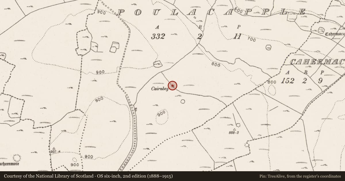
The record
- Townland
- Poulacapple
- County
- Clare
- Country
- Ireland
- First-edition OS map
- Hachured
- Latest-edition OS map
- Cairnbeg (1916)
- Coordinates
- 53.08256, -9.21006
- SMR number
- CL005-016----
Slide toward Today to fade the historical sheet and see the modern map underneath.
David Rumsey Map Collection, Stanford LibrariesDavid Rumsey Map Collection, Stanford LibrariesDavid Rumsey Map Collection, Stanford LibrariesDavid Rumsey Map Collection, Stanford Libraries
4 historical maps cover this location, the earliest the 1753 map "Mappa geographica Regni Hiberniae" (David Rumsey Map Collection, Stanford Libraries).
Historical maps covering this location
- 1753 · Mappa geographica Regni Hiberniae (David Rumsey Map Collection, Stanford Libraries)
- 1790 · Composite: Ireland. (David Rumsey Map Collection, Stanford Libraries)
- 1869 · Ireland. (David Rumsey Map Collection, Stanford Libraries)
- 1891 · Ireland 16 (David Rumsey Map Collection, Stanford Libraries)
This record in the National Monuments Service's Historic Environment Viewer ↗
The National Monuments Service's description
In rough pasture near the NE edge of a N-S ridge on the E side of the Caher valley, in a multiperiod field system (CL005-014001-). There is a good view of Galway Bay to the NE. Hachured on the 1842 and 1916 eds. of the OS 6-inch maps and named ‘Cairnbeg’ on the latter ed. In 1901, Westropp (1901, 278) recorded it as ‘the cairn of Cairnbeg in a wall in Poulacappel’
A large subcircular cairn (20m NE-SW; 19m NW-SE; H 2.8m) with some outer stone-facing visible at SE. A later field wall runs across it from NW-SE. Slab walls run 30m to the E and W off the S end the cairn before turning N to form a large irregularly shaped enclosure/field (c. 155m NNW-SSE); another modern WSW-ENE running wall crosses it at NE and NW. The relationship between the cairn and slab walls is not clear.
Compiled by: Olive Alcock and Ros Ó Maoldúin
Date of upload: 25 January 2022
References
Westropp, T.J 1901 Prehistoric remains in north-western Clare part II. Journal of the Royal Society of Antiquaries of Ireland 31, 273-91.
Nearby in the register
- Enclosureunder 1 mi
- Enclosureunder 1 mi
- Ringfort - cashelunder 1 mi
- Hut siteunder 1 mi
Other entries of the same register within about three miles of this one, by straight line.